We have a more suitable website version for you. Please confirm your country to get the right product availibility and even purchase online.

About Cookies on this site

We use cookies to collect and analyse information on site performance and usage, to provide social media features and to enhance and customize content and advertisements.

Learn more

About Cookies on this site

Cookies used on the site are categorized and below you can read about each category and allow or deny some or all of them. When categories that have been previously allowed are disabled, all cookies assigned to that category will be removed from your browser. Additionally you can see a list of cookies assigned to each category and detailed information in the cookie declaration.

Learn more


PROLOGUE

Words by Andy van Bergen

Original story published on Cycling Tips.

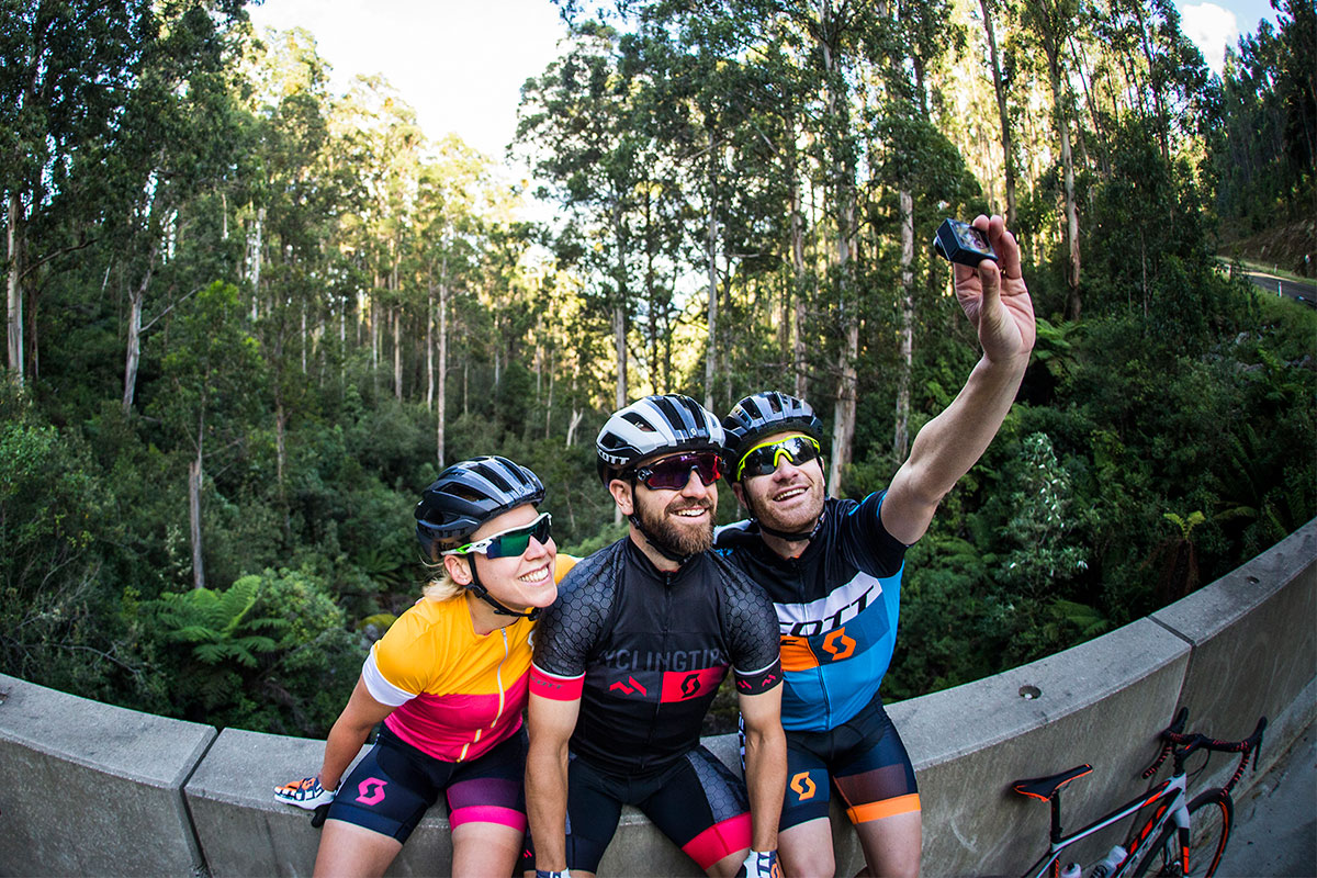
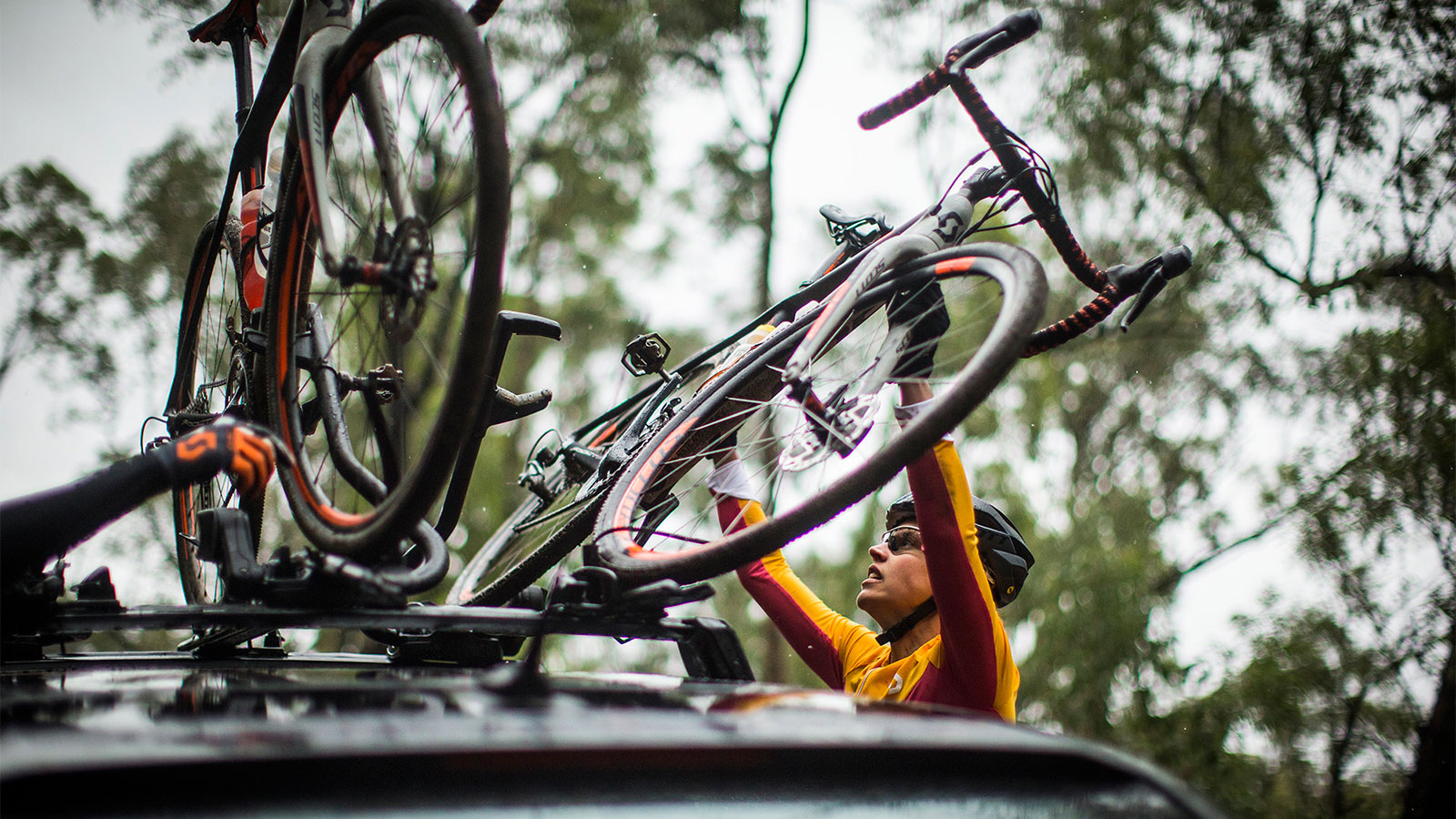
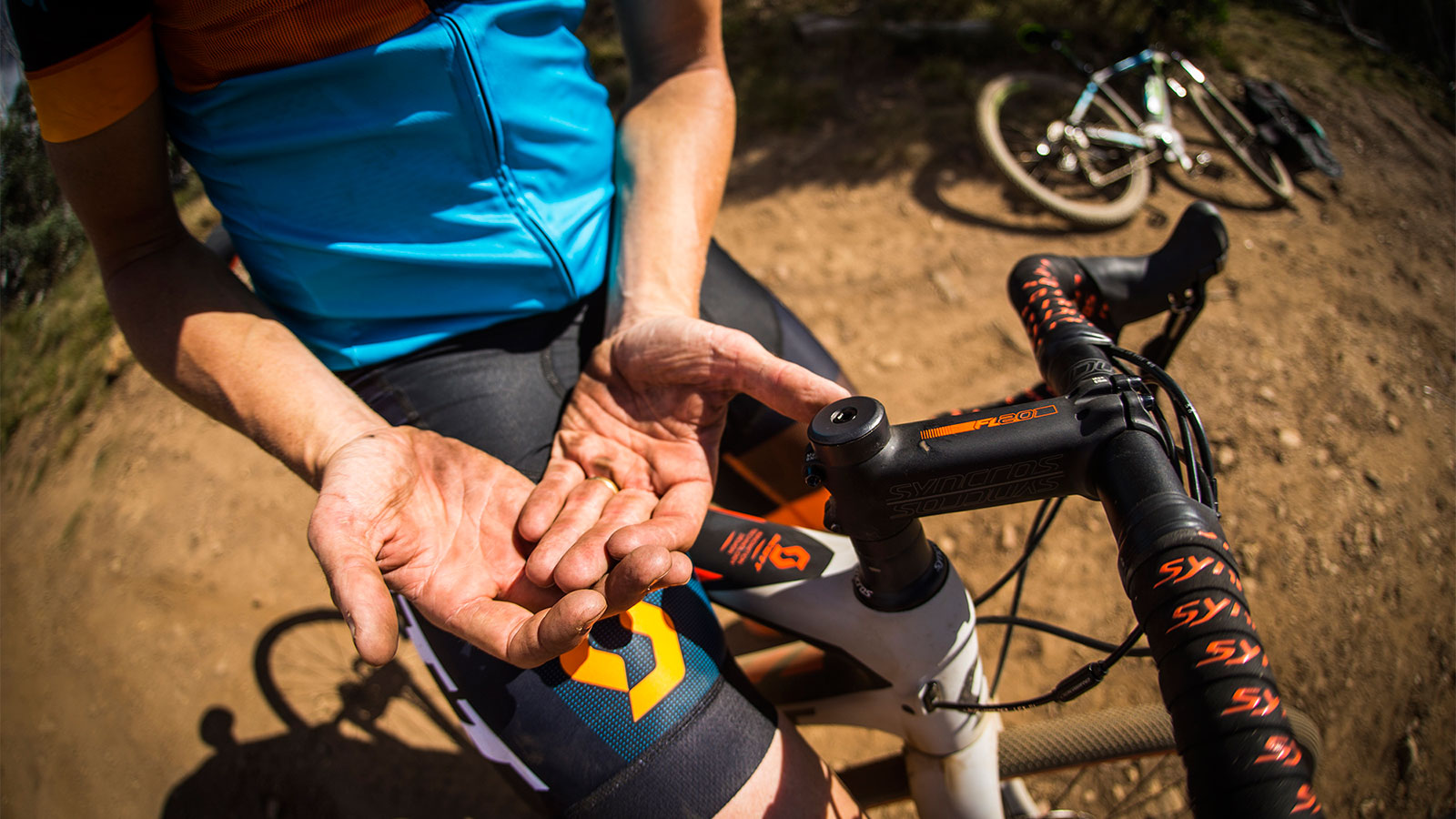
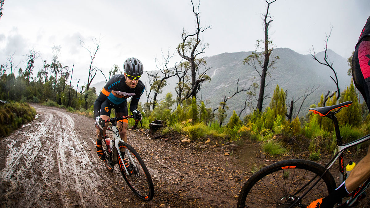
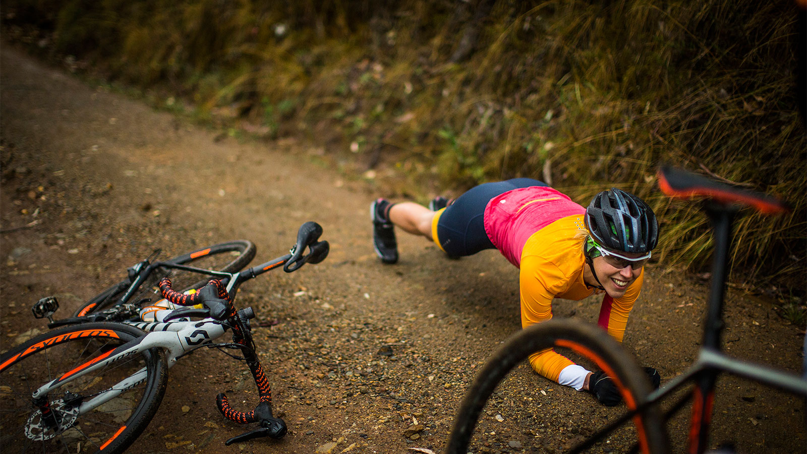
We rationalise our bike purchases by claiming they’re about enabling creativity. But in truth, when it comes to justifying spend in the emerging adventure cycling / gravel grinding segment, it’s really about reconnecting with childhood. A childhood spent exploring the outer limits of your neighbourhood on the pegs of a mate’s trusty Huffy.

We’re still aiming for puddles, the only difference is we’re not being called back in for dinner anytime soon.

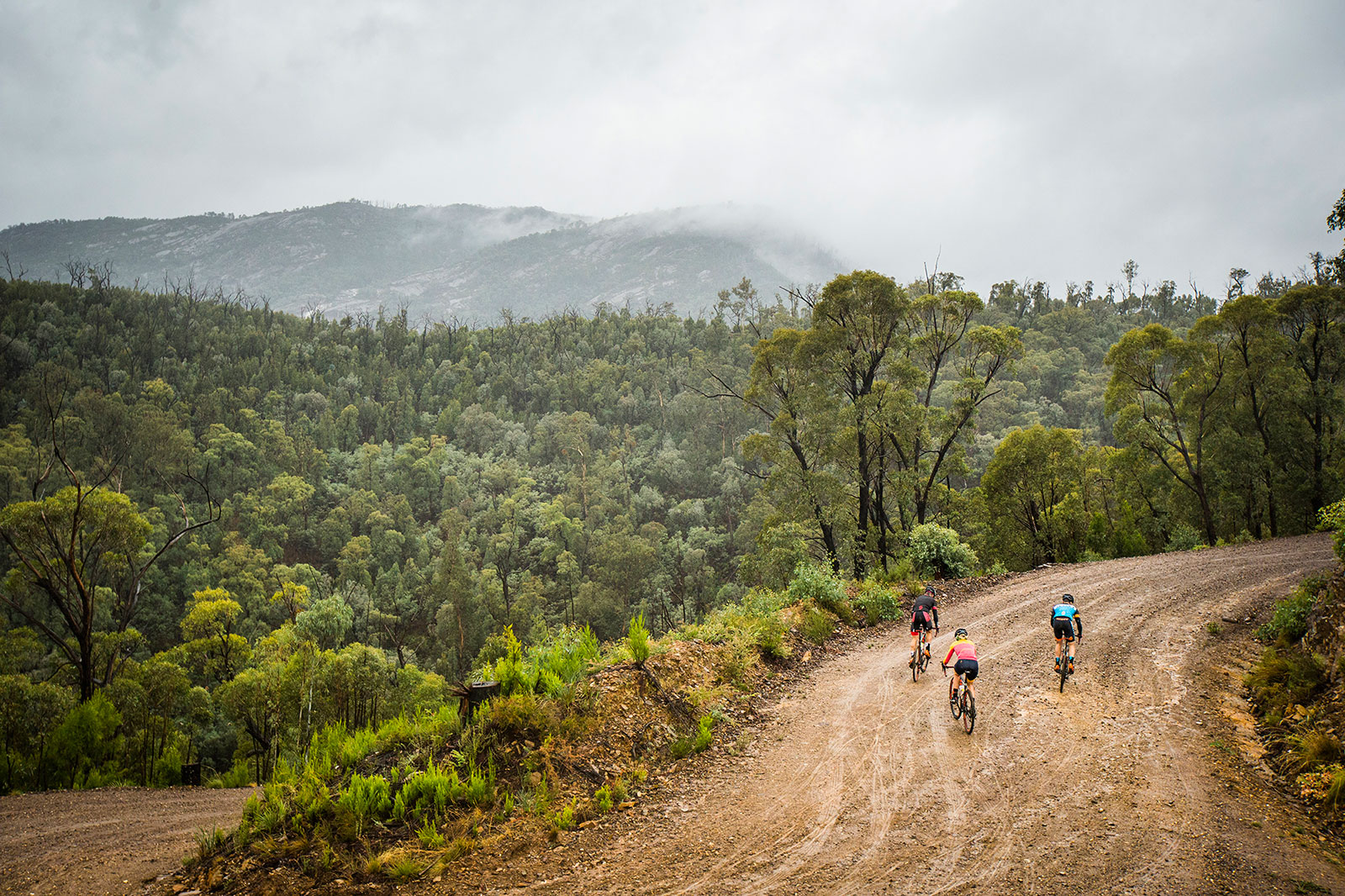
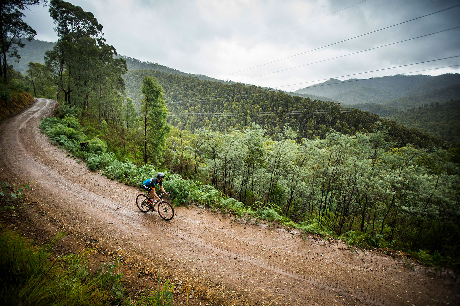
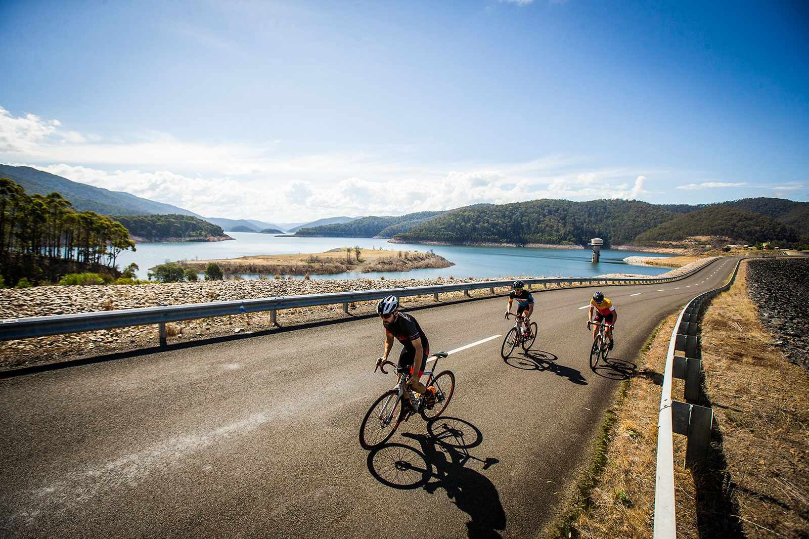
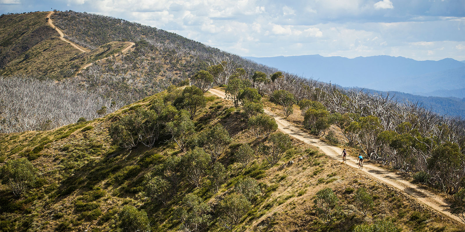
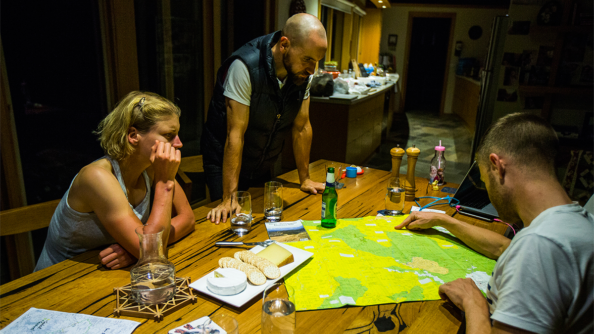
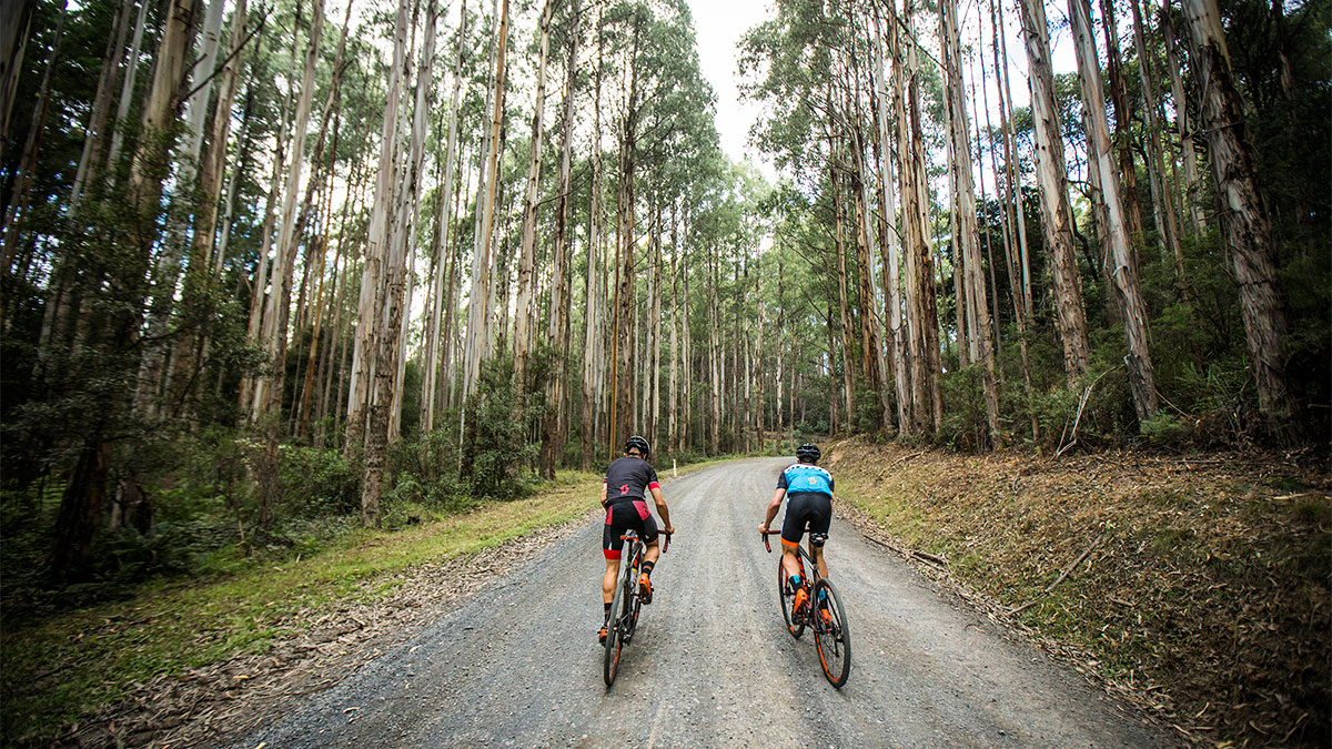
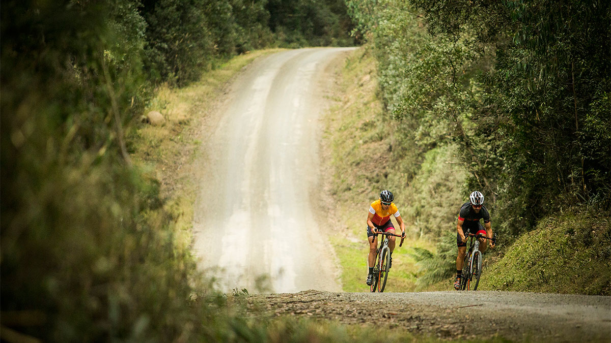
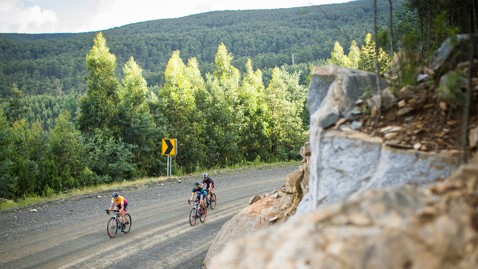
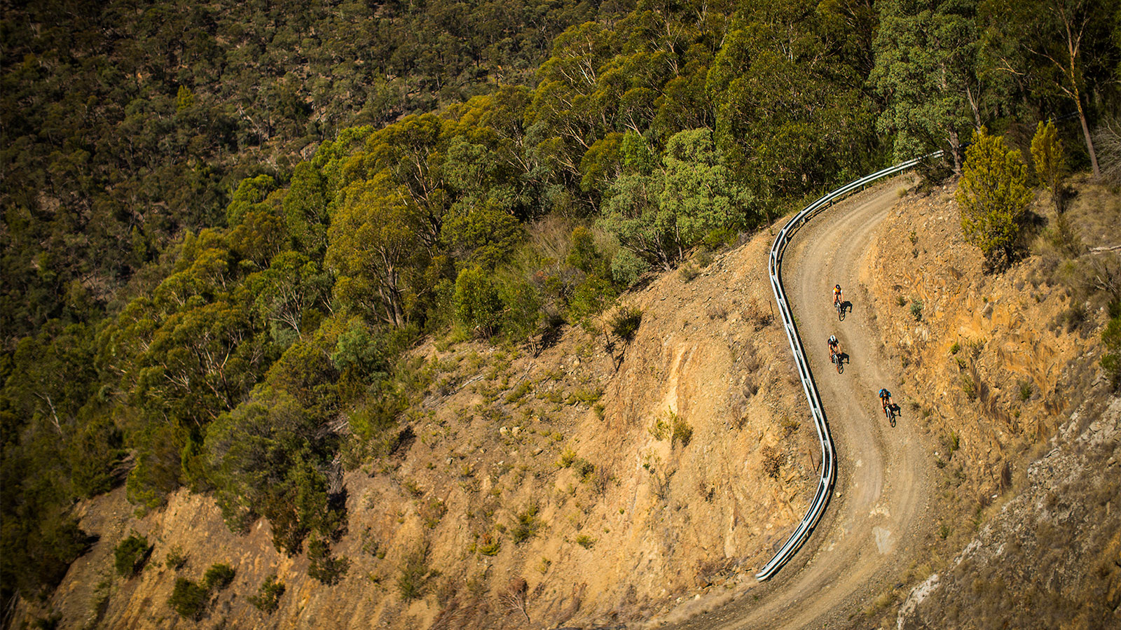
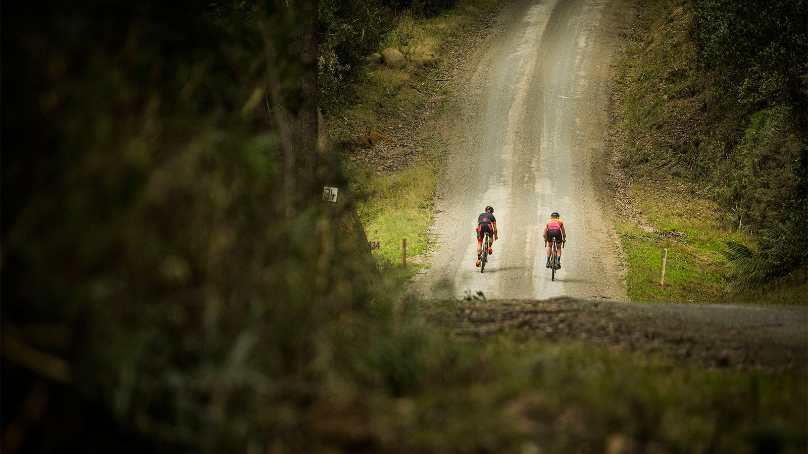
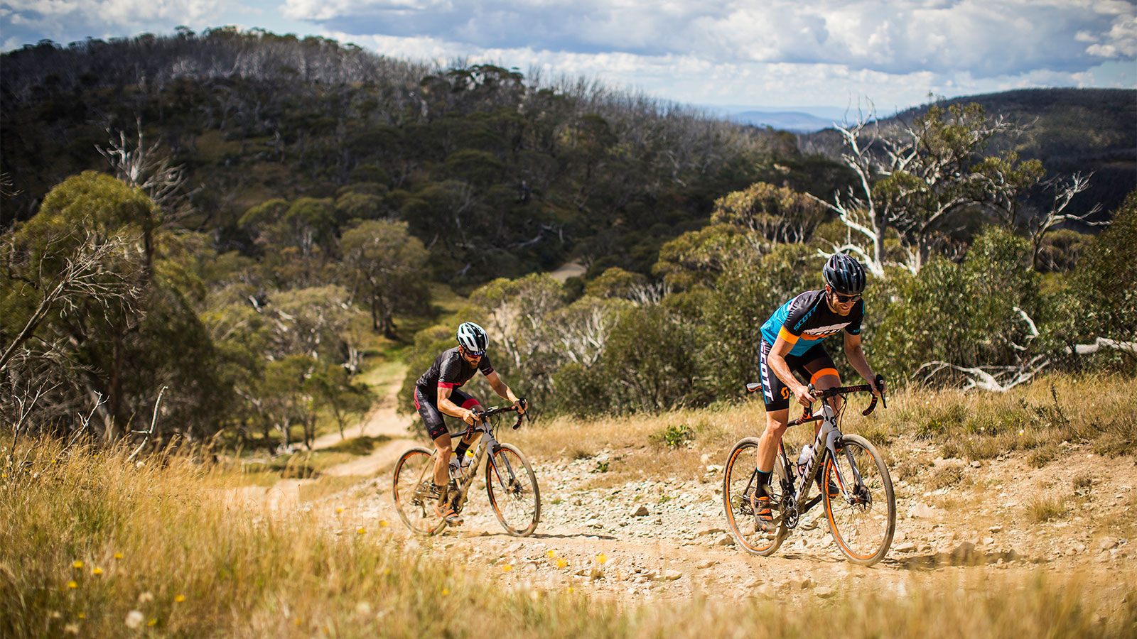
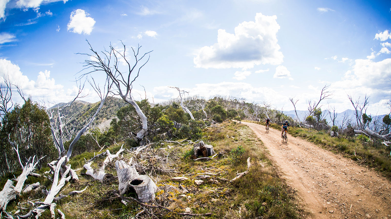
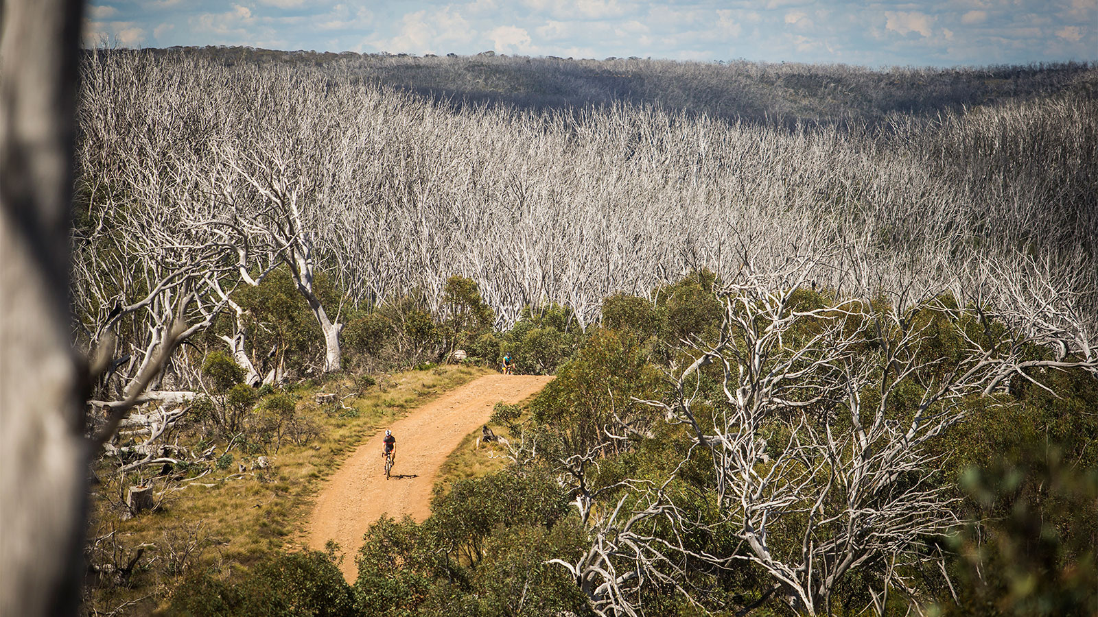
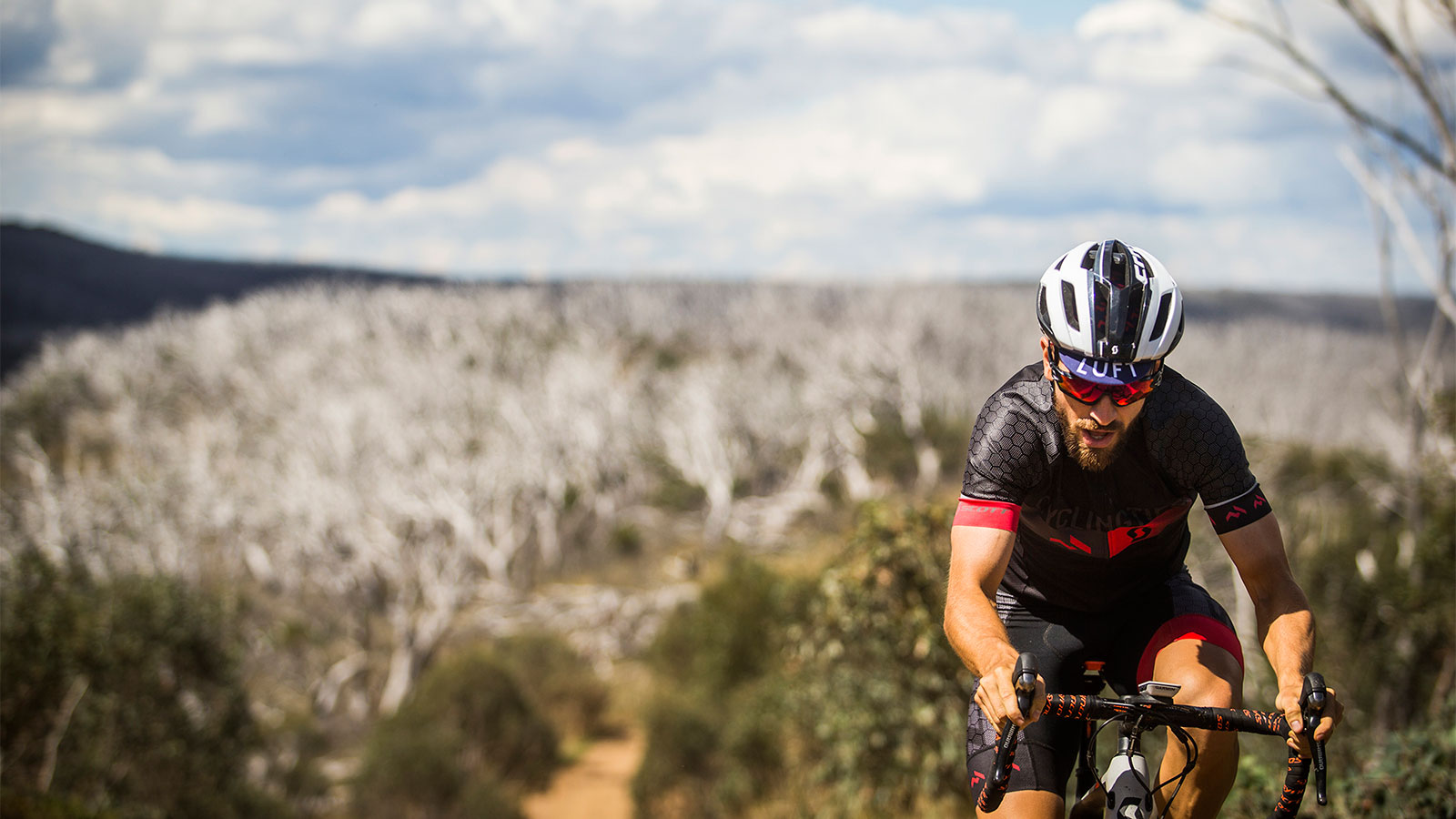
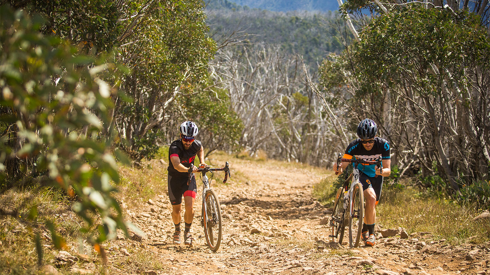
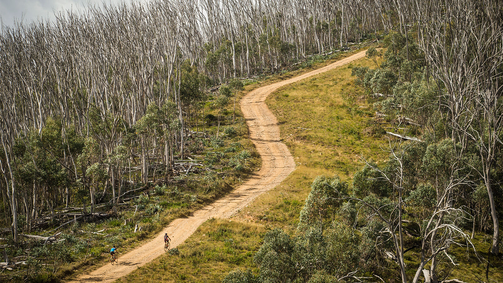
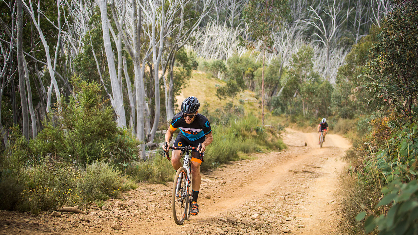
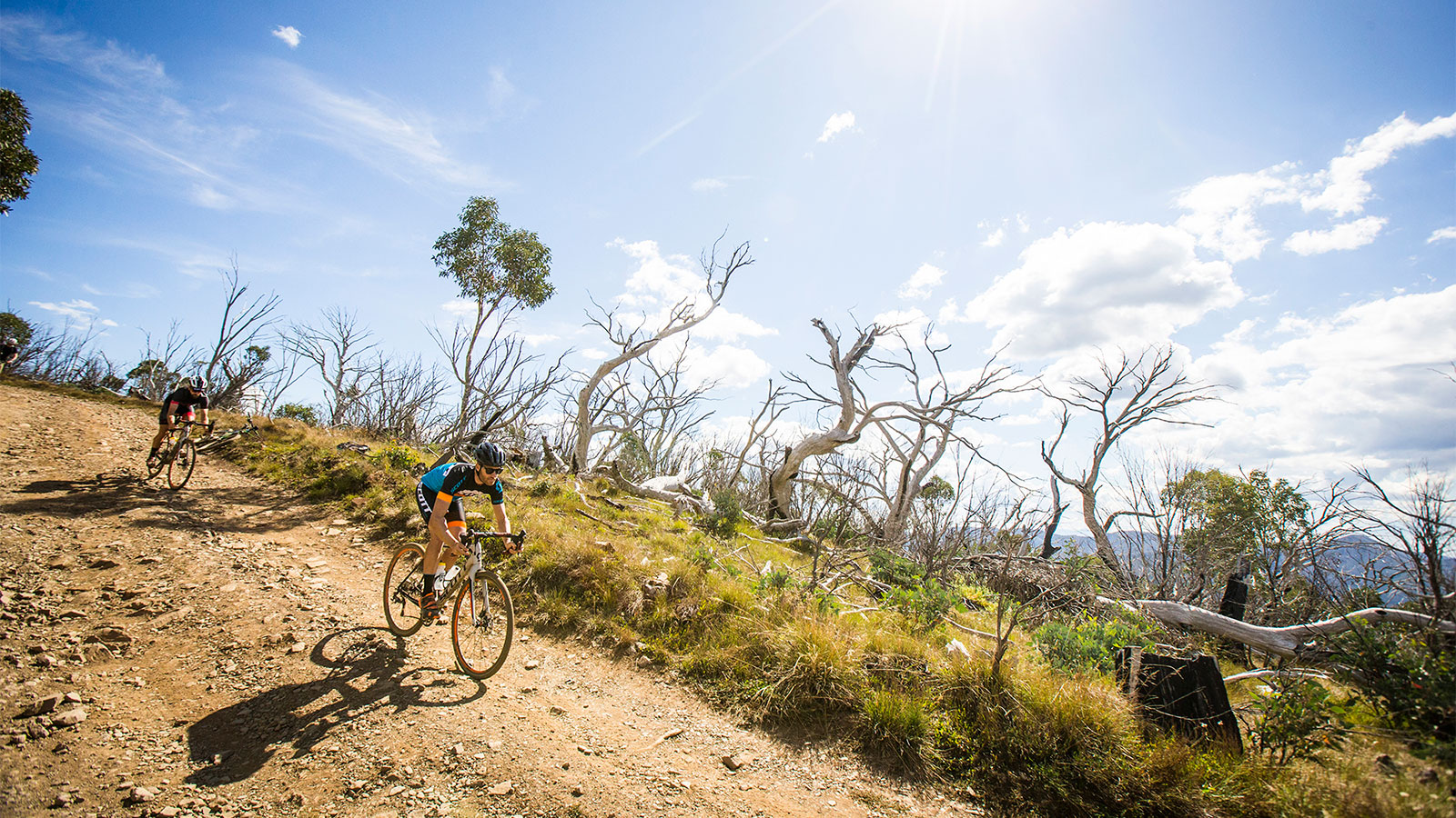
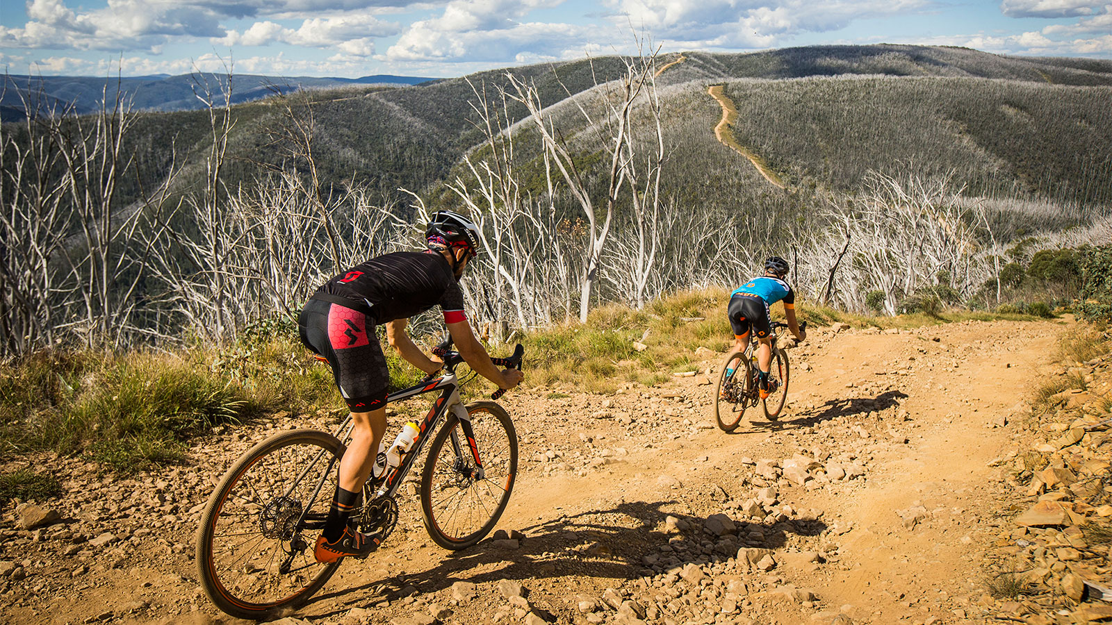
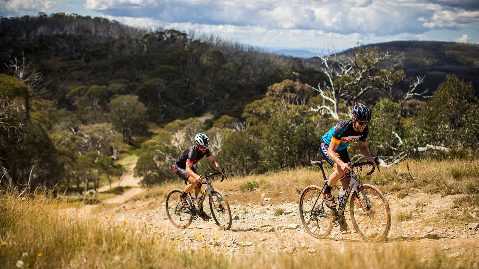
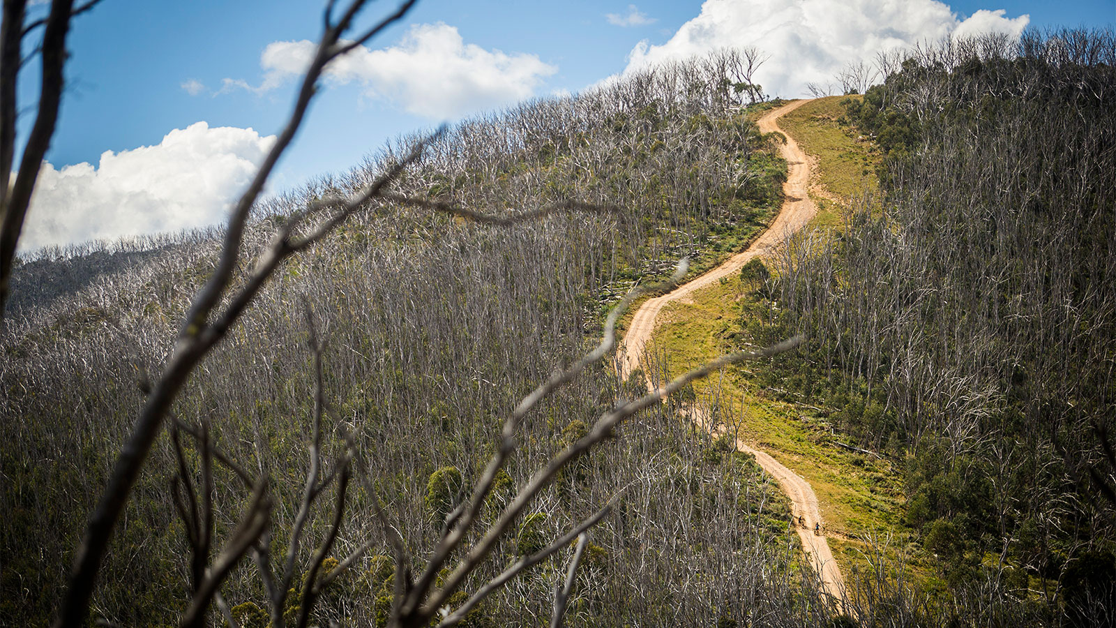
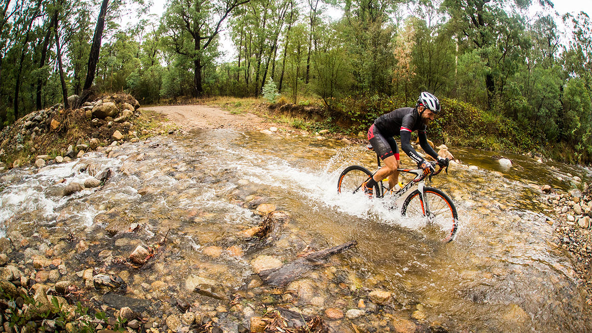
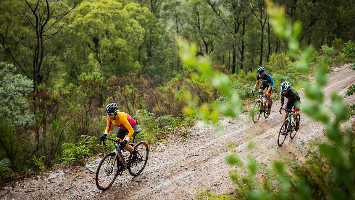
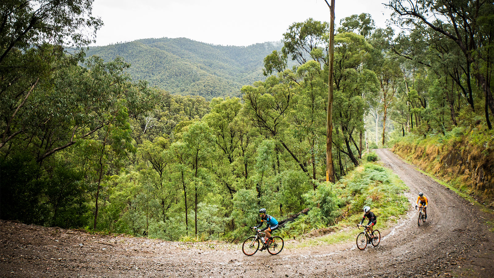
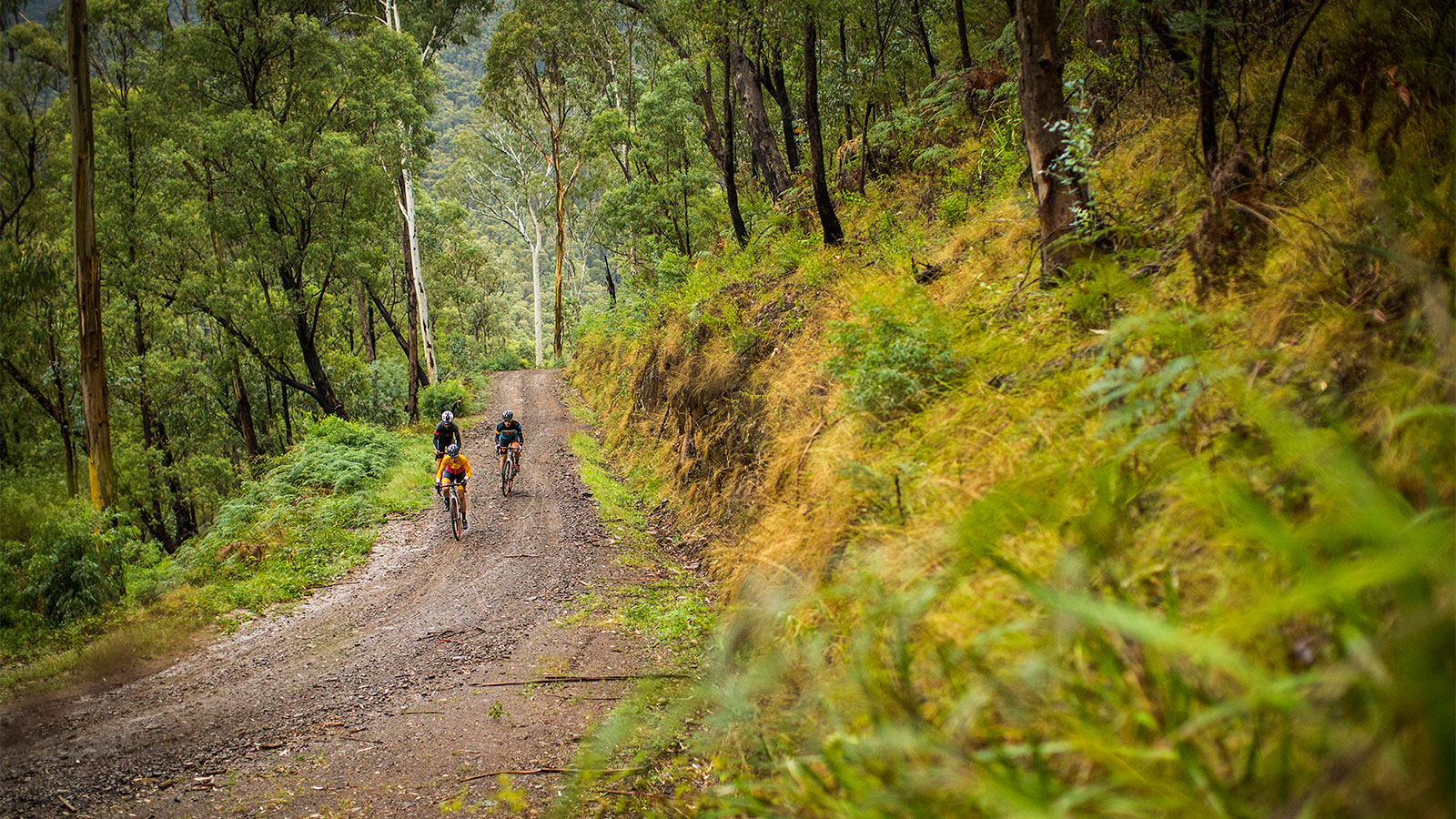
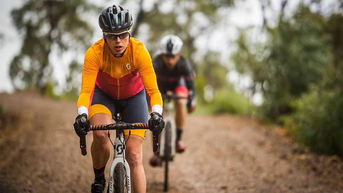
When it came time to plan our CyclingTips roadtrip into the lesser-ridden roads, tracks, and trails of the Victorian High Country, there were two things we were keen on.

Firstly, if these ‘gravel grinder’ bikes are vehicles to discovery, then we’d best be hitting routes listed on analogue topographic maps, rather than being limited by a Strava heatmap. Secondly, it was important that in addition to exploring new terrain, we wanted to have our cycling horizons broadened.


With that in mind, and over a couple of beers, we spread a pile of dogeared Rooftop maps onto the table in front of us and planned out the weekend. I’d be riding with two Roadtripping first-timers: Monika — fresh from years of riding the flats of Minnesota, and a previous World Gravel Race Champion — and Matt — an accomplished roadie from the Melbourne racing scene, a recent winner of the Preston Mountain Classic, but a rider with no experience on the unpaved off-piste.

It would not only be an opportunity to seek out new terrain, but to expose these guys to something completely different.

We settled on a cherry-picked list of lesser-ridden roads and tracks, personal recommendations, and ‘interesting features’ from the in-map notes, surely the highlight of any Rooftop topographic session.

The following morning, with last-minute adjustments to our Scott Addict Gravel bikes taken care of, we were on our way.


DAY 1: MT. ST. GWINEAR – THOMPSON DAM – MT. BAW BAW

Words by Matt Robertson

I came into this Roadtripping adventure as a road cycling purist. My background in gravel riding was limited to the occasional inclusion of a 5km tightly compacted gravel section on my daily commute.

This past summer there was a real trend in the Melbourne cycling community to get out and ride trails and gravel on a road bike; so much so that the hashtag #summerofgravel was created and was being used by seemingly everyone who owned a bike.

I took the opposite view of what constituted a fun day on the bike and only wanted a #summeroffreshlypavedroads. My preconceived idea of why people wanted to ride gravel was because they weren’t fast enough to keep up on bitumen roads!


One year ago I was faced with the true first-world problem of whether I wanted (I told my partner that I “needed’) my second bike to be a time trial bike or a cyclocross bike. I was undecided until I went and watched the cyclocross nationals race; it was freezing cold, I couldn’t feel my hands, my shoes were covered in mud and I was miserable just watching the race. Three days later I was the owner of a time trial bike.

So I went into this trip excited to be spending a quality week riding some amazing roads but I was sceptical about the chosen terrain and the bikes.

Arriving at the summit of Mt. Baw Baw in the late afternoon it was immediately apparent, as we shivered our way through the gusting sideways sleet, that the Melbourne summer was about to be banished into distant memory. The first night I was woken a number of times by the sound of heavy rain which had me more than slightly nervous about the ride we had planned.


The route we had scratched into a battered photocopy of a Melways map was a 126km mix of gravel and asphalt and included more than 3,000m of elevation gain. Two long, pinnacle climbs, the Mt. Saint Gwinear gravel climb and the infamous Mt. Baw Baw road climb, were reduced to place markers on the map, but we knew what those highlighted names represented.

For anyone who doesn’t know Mt Baw Baw, it is considered one of Victoria’s toughest climbs due to its unrelenting steepness. It averages 11% over 6.4km and has pinches of over 20%. That was to be the finishing gift, waiting patiently for our smashed legs many hours later.

It was unfamiliar to start a long ride with a descent, and I would almost have felt like it was cheating if I didn’t know we 

would be climbing back up to Mt. Baw Baw 10 hours and 120km later.

It was the first opportunity I had to acquaint myself with disc brakes, descending the very steep switchbacks of Mt Baw Baw. I was really impressed by the amount of modulation and stopping power they provided at high speed; I now understand what all the fuss is about. On such a technical descent it was a welcome change not having the lingering worry of overheating a set of rims.

I’ve been told in the past that I descend like a triathlete. I wish those people could have seen me with my new-found confidence on disc brakes. I was now descending at least as well as a duathlete. 


At the base of Mt. Baw Baw we began our first long section of gravel. I quickly realised that being on a purpose-built bike was a lot different to any gravel riding I had done. The bike was actually gripping around corners instead of the front wheel washing out, and the tyres were responsive on short, pinchy climbs.

Giving me a gravel grinder was like taking me back in time and giving me my first BMX. Only this time, instead of avoiding puddles, I started riding straight through them and I would take any opportunity to do a skid or attempt a wheelie – usually unsuccessfully.

As we ground on, I slowly started to get a greater appreciation of why this whole gravel riding trend is growing; at its simplest, it’s about the endless freedom to explore. When we were climbing Mt. Saint Gwinear there were a number of fire tracks off the main road which we would constantly look down and say “do you think that’s rideable?”

It wouldn’t take much egging on to head down some of the more interesting and enticing side tracks, and as we negotiated the slippery rutted-out water-filled clay ditches we would find out pretty quickly if we had ambitiously bitten off more than we could chew, or if we had discovered a hidden gem.


I also learned the hard way that you are a lot more susceptible to mechanical issues when riding on such varying terrain. With 40km still to go and in the middle of nowhere a stick jumped up and tore Andy’s derailleur in half. Not a broken hanger, but a clean break in the body of the derailleur.

We were fortunate to have a support car because the only other way we could have continued was to turn the bike into a single-speed, and the likelihood of being able to climb the final Baw Baw climb on a single-speed, and the likelihood of being able to climb the final Baw Baw climb on a single-speed is very slim. It would have been a very slow walk.

With one bike now relegated to the roof racks we continued onwards (and upwards) to Mt. Baw Baw. The climb was only made manageable by the generous 34-32 gear ratio we had and we eventually reached the summit just as our long shadows gave way to an eerie gloom.

In two days I went from a gravel skeptic to an (almost) gravel convert. Whilst I haven’t swapped out the time trial bike just yet I have decided that it’s time to invoke the n+1 rule.


DAY 2: BLUE RAG RANGE TRACK

Words by Andy van Bergen

We couldn’t decide if the map footnotes against the Blue Rag Range made us desperate to check it out, or keen to stay away. It probably should have been the latter.

“Caution. This track contains extremely steep pinches in sections, and loose rock can make going difficult”.

Another footnote read: “This track was ridden by a cyclist in its entirety in 2015”. The fact this achievement was worthy of its own note (the only cycling-related note on a 4WD map) suggested we were very much heading onto the path less ridden.


From where we were at Mt. Baw Baw we weren’t that far from Blue Rag Range, a scratchy highlighted mark on the map which collected and dumped tightly-packed topographic rings a little too easily.

Close on paper, but we were still looking at a four-hour transfer by car. With the first half of the day allocated to travel, it was a chance to take in the surroundings, briefly reconnect with the real world of emails and deadlines until, mercifully, we were cut off again somewhere near Dargo.

As we arrived at the Dargo Hotel (looking for a tree-change? The lease is currently up …) it was a bit of a mid-week

surprise to see large groups of cyclists at this pub in the middle of nowhere. 

Gathering for a break, the riders of the Chain Reaction Ride would be in for a post-lunch surprise.

Almost immediately after leaving town the road pitches upwards and upwards in a seemingly never-ending series of ramps and walls, made famous as the brutal final 10km of the Stratford-Dargo race. As we hit the plateau, we had the Big Country to ourselves … aside from a lazy herd of cows slowly making their way along the High Plains Road.


It was unclear on the map just how close to the start of the ridgeline we’d be able to get. Straight out of the car was a deep ditch followed by a multiple-pitch 20%-plus rutted-out ramp. There was no choice but to saddle up, select the biggest cog, and slowly pick our way up the crumbling wall.

As we rounded the first crest we saw what was to become our playground for the next few hours. Rolling and snaking impossibly into the distance was a scar of a track, ignoring conventional low-gradient road-building wisdom, and simply taking the highest line along the ridge.

Although we could see the rolling top of the track extending before us, it wasn’t until we reached the crest that we realised how far the trail dropped below us, before snaking up again, and then down again, and then up …


Staring at the extremely steep descent, and the matching climb out the other side, we placed bets on the gradient. It looked tough, but then there was little to give it perspective. As we agreed and disagreed on how possible it was to ride, we noticed a dot of a 4WD slowly (very slowly) making its way down the track. The first sounds started filtering across the gap toward us and it became apparent how carefully they were tackling the descent.

It was the struggled sound of straining engine braking, mixed with underbelly of the vehicle scraping the mounds formed between the deep ruts, rocks slipping and pinging out of the way.

“Let’s just ride this first one, and see how things pan out”. It was a statement that would be repeated for the next few hours as we worked through barely-controlled descents (sometimes having to walk down to avoid ripping chunks out of the tyres) and climbs that were a set of mini competitions between us to “see if you can ride to the next washout”.

With mouthfuls of dust, and sweat splashing off the inside of our glasses, we were all thinking but not verbalising the obvious fact: wherever we stopped, we were only half way.


Eventually we reached the trig point – a survey marker originally used to accurately measure the High Country and celebrated with a double-ration from the bidon. Our reward for the single-digit average speed ride was a blue-on-blue multi-layered 360-degree view into infinity.

A group of 4WDers gave us a bemused expression and slung a couple of light-hearted jibes as we hunkered over our “push bikes”, baking in the sun and contemplating the ride back. Sure, a mountain bike would have been much more suited to this road, but then it wouldn’t have been nearly as fun.


DAY 3: GOLDIE SPUR TRACK

Words by Monika Sattler

In direct contrast to the sun-baked day we’d had in the High Plains, we woke up to massive rain showers the following morning. Even though it was closer to a thumping on the roof than a gentle pitter-patter, I had quickly learned that adverse weather conditions were not something that would keep this crew inside. But we still enjoyed a second (and then third) cup of coffee and dragged breakfast into a two-hour-long meal/procrastination session.

But no matter how long we waited, it wouldn’t stop raining. Today would be wet!

The first destination on the map would be Goldie Spur – a long gravel ascent around the back of Mt. Buffalo. We’d all ridden the traditional Buffalo climb before, but tales of quiet gravel roads circumnavigating the granite-bouldered mountain had us curious and keen to experience it ourselves.

The heavy rain had turned the gravel into dough-like paste and it didn’t take long before Andy, Matt and I were competing to see who would get the muddiest. “Monika, you need to stop avoiding the puddles. Why are you still so clean?” I could see where this was going.


The scenery and the extraordinary weather conditions gave this place a mystical feel. The low hanging clouds. The mist in the air. The gloomy light. The occasional sunrays through the thick cloud patch. The temporary waterfalls spilling down the cold rock face of Mt. Buffalo. The spectacular views over tree-filled gorges.

Every corner was a new view, another opportunity for us to pull out the phone and wipe the rain off the lens for another amazing photo. It was such a stunning, picturesque setting.

Admittedly we hadn’t done our proper due-diligence that morning and the climb was substantially more significant than we had expected. Saturated from the rain, and kept wet by the hugging mist it didn’t take much wind to produce Antarctic conditions at the top. We shivered, layered up, swung blood into our arms and blew on our fingers in an attempt to warm up before the long descent.

A mixture of wind-formed tears, rain, and mud from the track streaked across our faces as we dropped lower and lower, eventually falling below the cloud into the comparatively ‘warm’ and wet conditions below.


The unexpected highlight of the descent was the rapidly rising creek that was forming across the gravel road. What was marked on our map as a dry riverbed crossing was now a wide flowing torrent of water.

We thought back to the small streams we had crossed on the other side of the mountain earlier in the day, and quickly realised there was a pretty good chance they would now be flooding too. We didn’t just have to ride through them, we had to get our support car through too.

Riding through the water several times to gauge depth, we decided it was now or never, especially considering the amount of rain we had experienced higher up; rain that was now working its way down towards us. We all held our breath as the Holden teamcar bounced through the stream and emerged on the other side.

We loaded up the bikes (with an additional 10kg of mud) and hunkered together in front of the car heater as we took off again.


We’d gone into the week with a mixture of highly planned ride sectors, and ‘educated guesses’. We’d seen how quickly we could get lost (Pro-tip: torn photocopies of Melway maps do not provide enough detail), and had a dramatic reminder of how quickly the weather can turn in the High Country.

We’d been readily diverted down intriguing sideroads, challenged on terrain the pushed the limits of our bikes’ capabilities (not to mention our own), and had waded our way through a day that would keep all but the most dedicated roadies inside.

As a still-emerging area of the sport, adventure cycling can be somewhat difficult to define. But if our time in the Victorian High Country taught us anything it’s that adventure cycling can be described as an eclectic mix of experiences you simply can’t get elsewhere.


Photos by Tim Bardsley-Smith