Headed North – Against the wind with Tanner Stephens
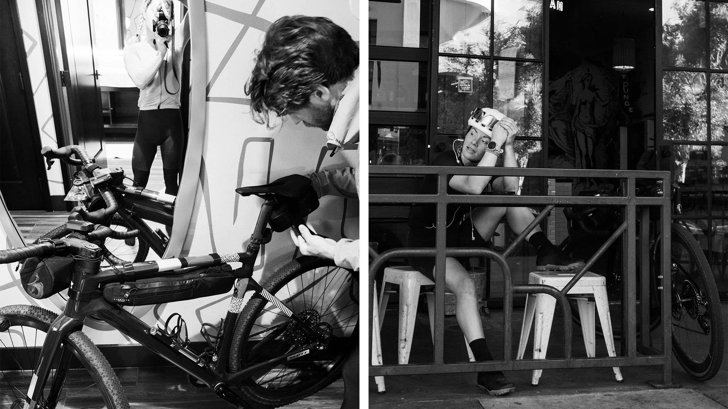
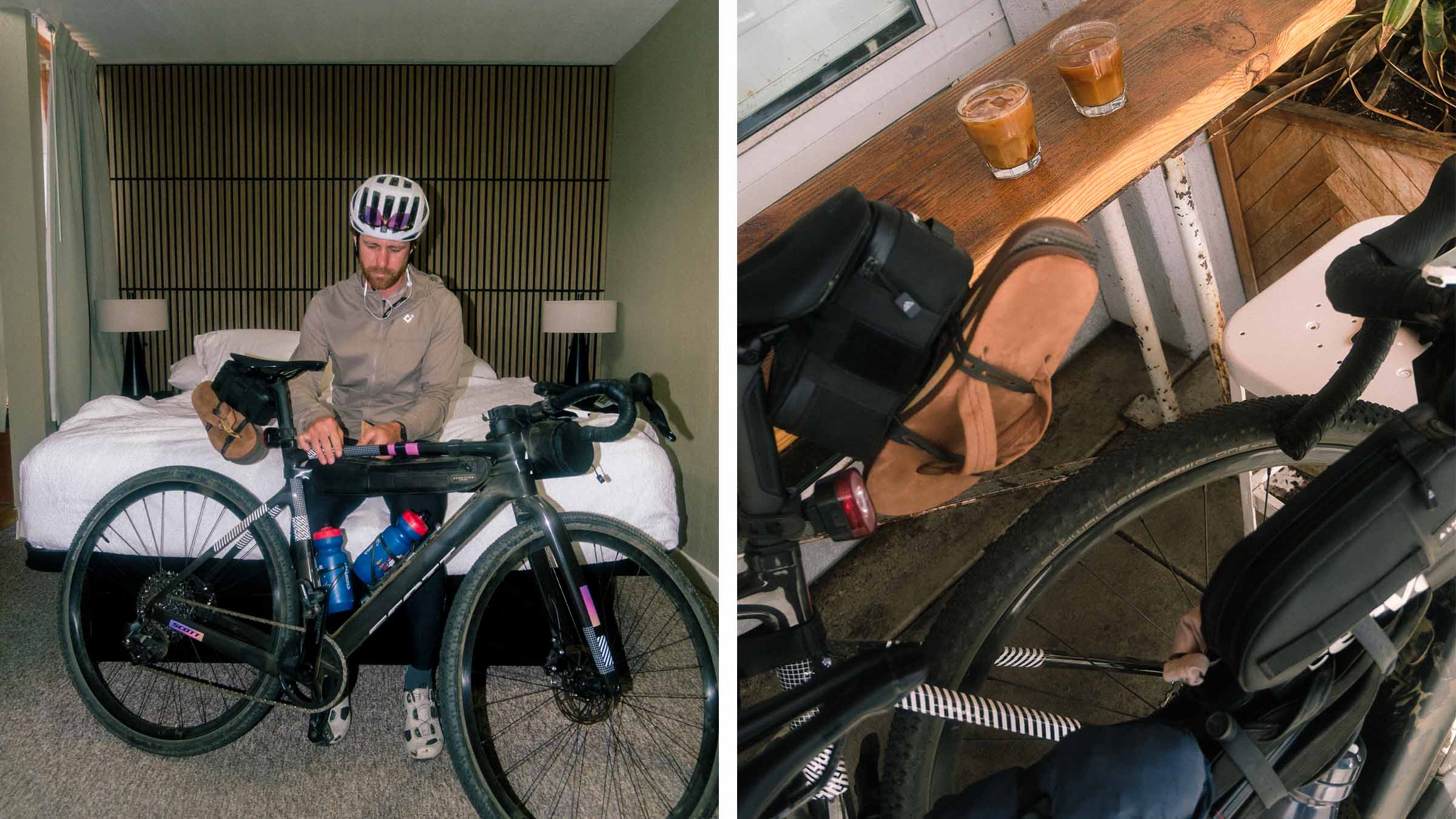
The bike is loaded: one pair of non-riding clothes, one riding kit (wearing), camera, flip-flops, bottles, snacks, credit card, and one northbound train ticket. That’s how Tanner Stephens and Diana Drew started a four-day bike adventure on California’s central coast. They had a destination in mind, most of a route, many miles of riding ahead with plenty to see and roads to explore; deviation from the “plan” was almost expected when they rolled North out of Santa Barbara…
Words and photos by Tanner Stephens:
Have you ever dreamt of leaving your front door to ride your bike for an unknown amount of time? To simply enjoy the freedom of turning over the pedals and experiencing new roads or trails? Maybe even doing so for multiple days? Well, I’ve dreamt of this a lot over the years. More times than I’d like to admit. However, I’ve never actually acted on this impulse until recently…
One day while out riding the coast near where I call home in north county San Diego, I noticed the wind was unusually strong coming from the south. Triggering a memory of past thoughts or desires of riding north up the coast of California to where I grew up I n the San Francisco Bay Area. The reverse of what most people do.
Before departing on this adventure, I decided to ask my good friend Diana Drew if she’d like to join in on the adventure. She immediately checked her schedule, then confirmed that she’s in! Both of us have ridden between LA and San Diego plenty, so we decide to skip out on that section and begin the ride more towards the regions we haven’t spent as much time.
DAY 1: Adventure, just a train ride away
Having changed our plans a couple times now; my alarm yells out at 4 AM to catch the first northbound train of the day at 4:57 AM out of Oceanside. Heading north into Orange County and Los Angeles, making a left turn after the Hollywood sign, motoring straight through the boulder covered peaks of the valley, then making a hard right as we nearly touch the beaches of Ventura, we eventually arrive at our destination of Santa Barbara.
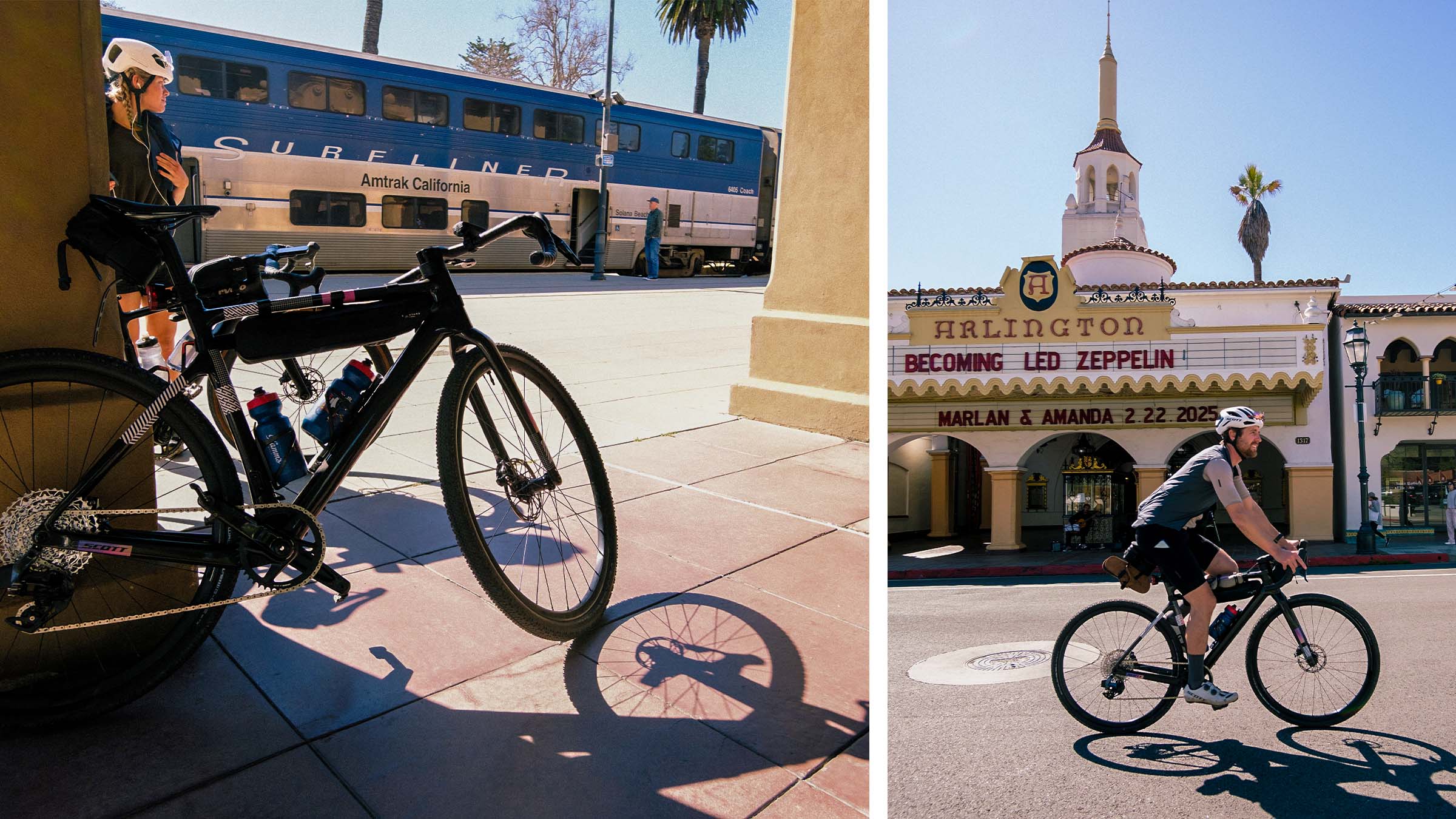
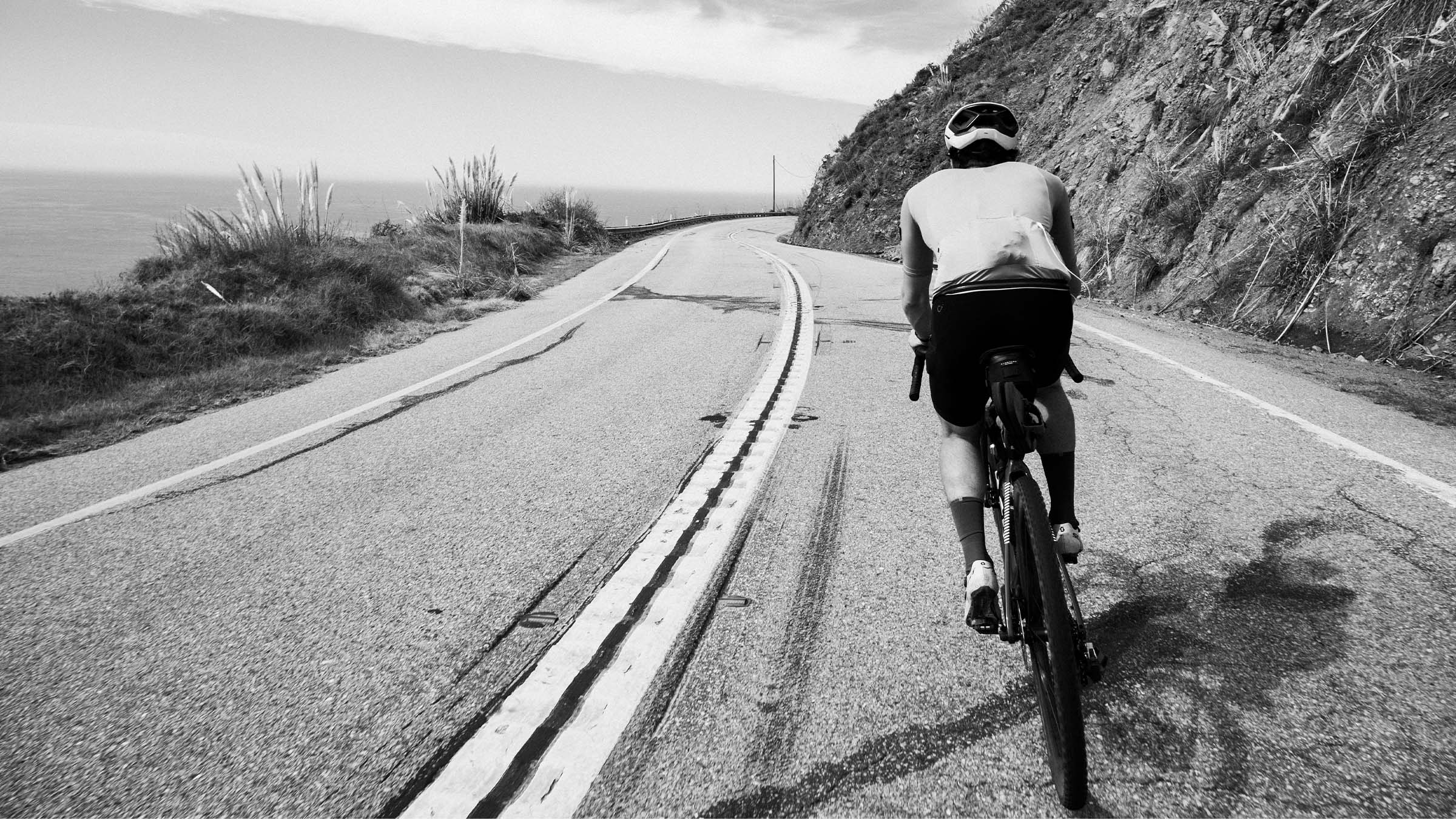
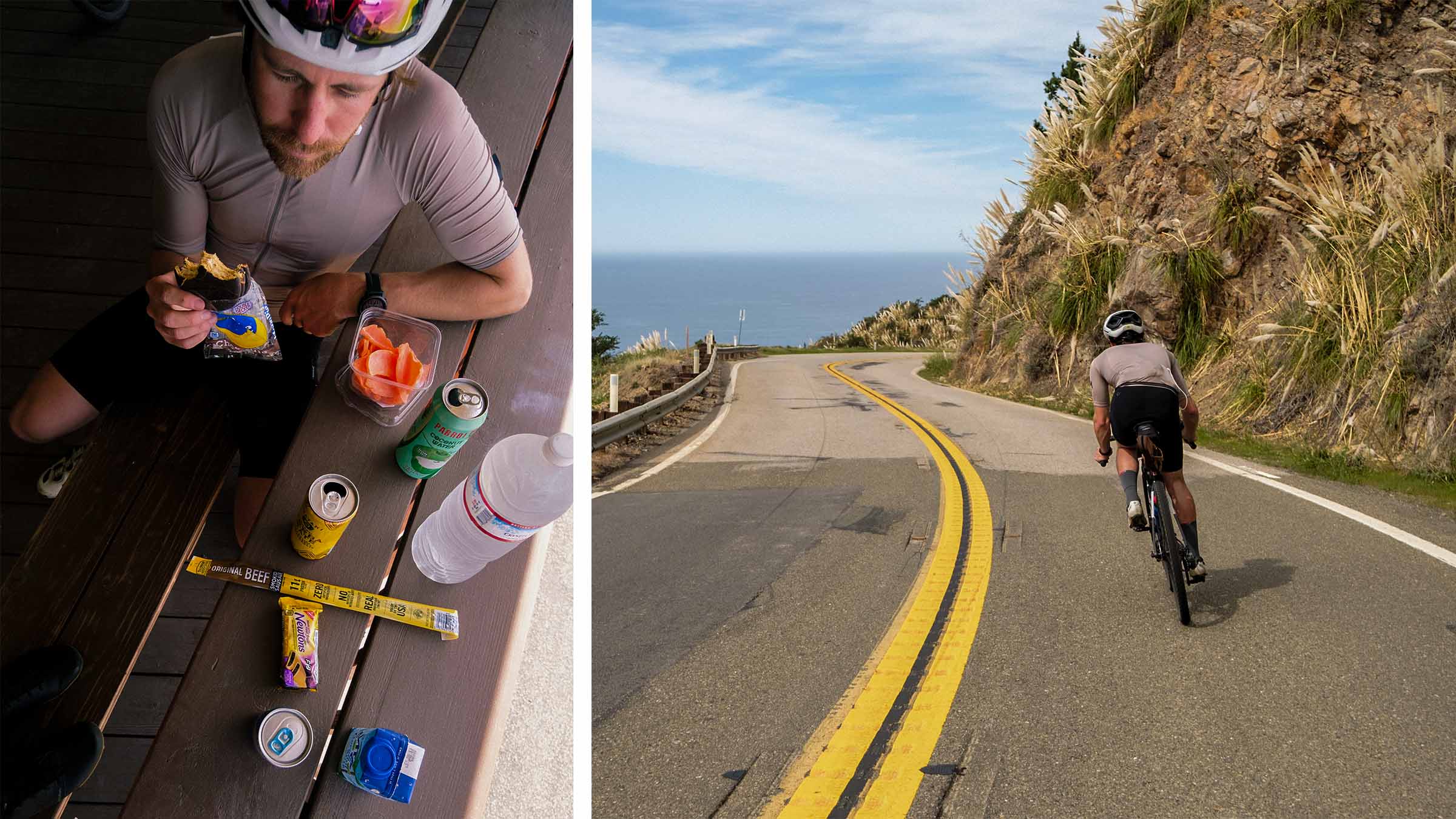
Hopping off the train we look for a safe place to change into our kits, then we’re off to Handlebar Coffee to grab a late morning pick-me-up before climbing over 4,000 ft in the first 15 miles of the ride. The late winter sun lays heavy on our shoulders as the thick air of a humid day escapes our lungs. Slowing to a leisure pace, we navigate the iconic Gibraltar climb, knowing this is just the first of many climbs we’ll face. A once spectacular stage ending climb to the now defunct Tour De California, and regarded by some as the Alp Du Huéz of California, it snakes its way to the top of the ridge looking down on Santa Barbara. Winding around smaller peaks jutting out from the mountainside, across ridgelines, up quick steep punches like sets of stairs carved into the hillside, gradually arriving at the top of Gibraltar Road.
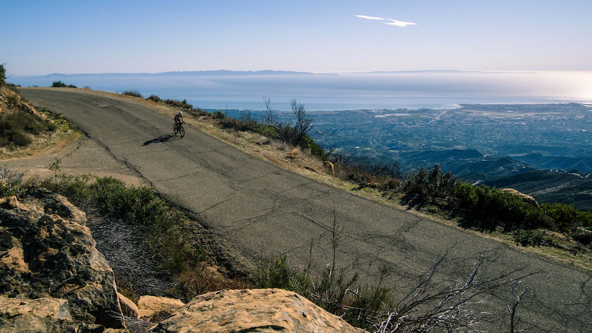
But this isn’t actually the top… From here we take the ever-so-slightest left to continue on East Camino Cielo. Now receiving a quick break from the past hour of high zone 2/zone 3 heart rate as we gain speed on a short downhill, all while looking up at the next thousand feet of climbing or so we have before reaching La Cumbre Peak.
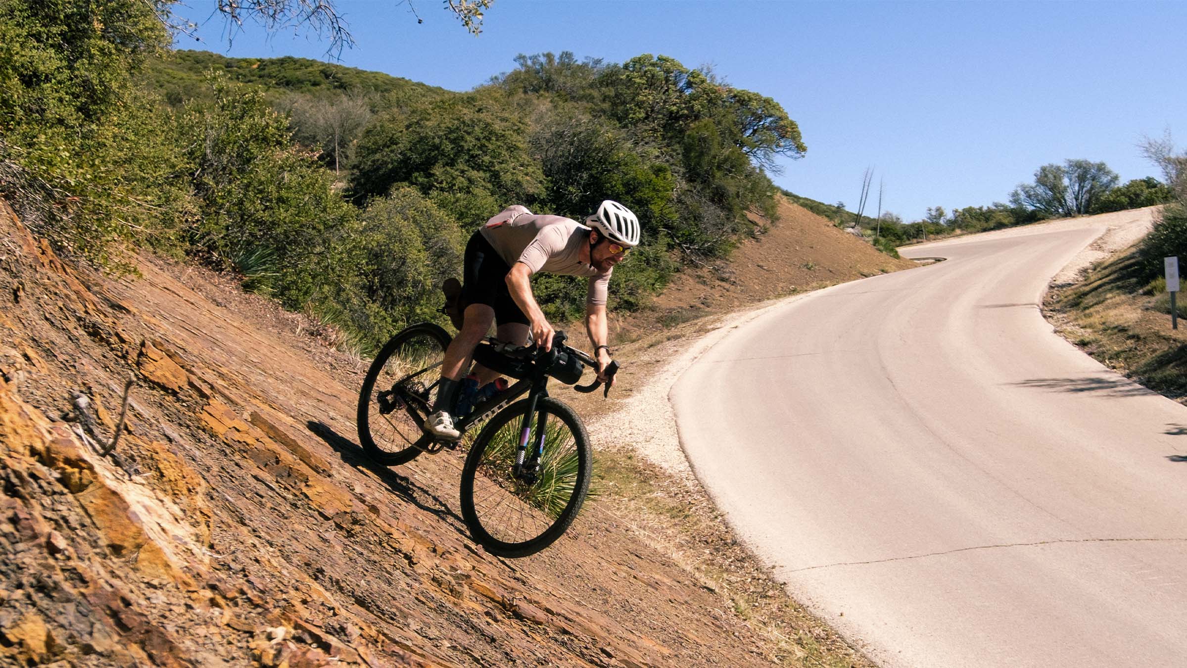
With heart rates declining, I spot a pleasant looking rock wall ride off the side of the road and steer towards the wall with a smirk. As I’m getting closer I start to realize it may be bigger than expected… but now committed, I can’t back out. Going faster than I thought, my tires hit the loose gravel shifting the bike underneath me. Quickly I go from road, to gravel, to the top of the rock face with my smirk turning to a full blown smile! Diana laughs as she shoots a photo of me hitting the wall ride on a fully loaded gravel bike with a pair of sandals hanging off my saddle bag.
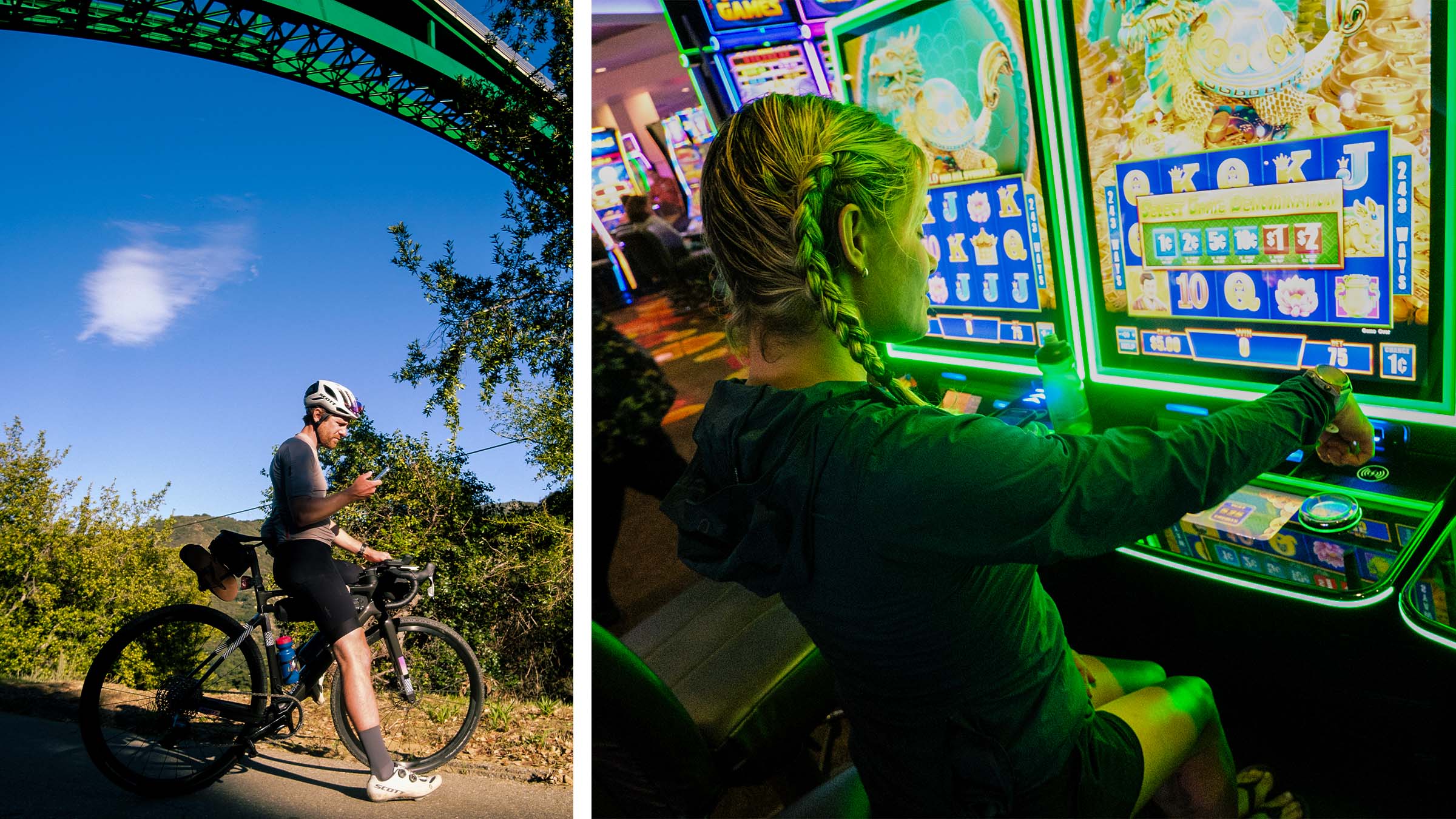
Continuing on, we climb to the top of La Cumbre peak, proceeding northwest across the ridge towards highway 154. We cross 154 and down Stagecoach Road we fly. Passing a fantastic barbecue spot called Cold Springs Tavern, which is unfortunately closed (must stop if it’s open), under the grandiose bridge of highway 154, and finally merging onto highway 154 for 12 miles or so as we make our way to the Chumash Casino and Resort.
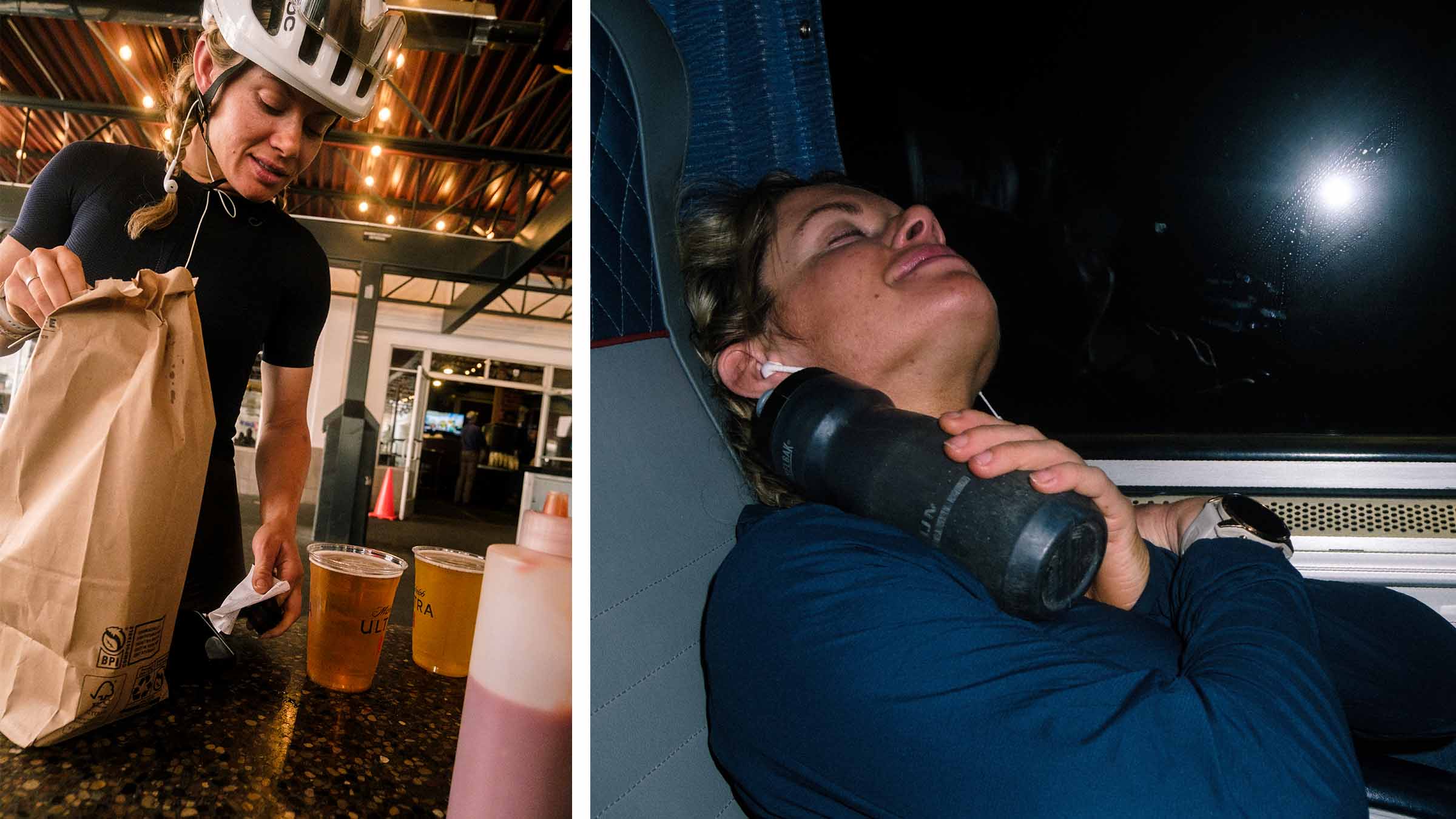
Cresting the final small hill of the day we can now see the Chumash Casino. We aim our bikes straight at the front desk and ask for a room. We get a room for the night, clean up, wash our kits, and take the elevator down to one of the few restaurants in the resort for a huge dinner after 5,500 feet of climbing in 45 miles.
DAY 2: Sunup to Sunset, keep the pedals turning
Waking up is easy when all you have to worry about is riding your bike all day.
Sliding out of bed, hoping our kits are dry from washing them the evening prior, we begin packing our bags, attempting to make everything fit better than it did the day before. Luckily our kits are dry, and we check out. Straight to Queens Cup Coffee we go to grab coffee and breakfast.
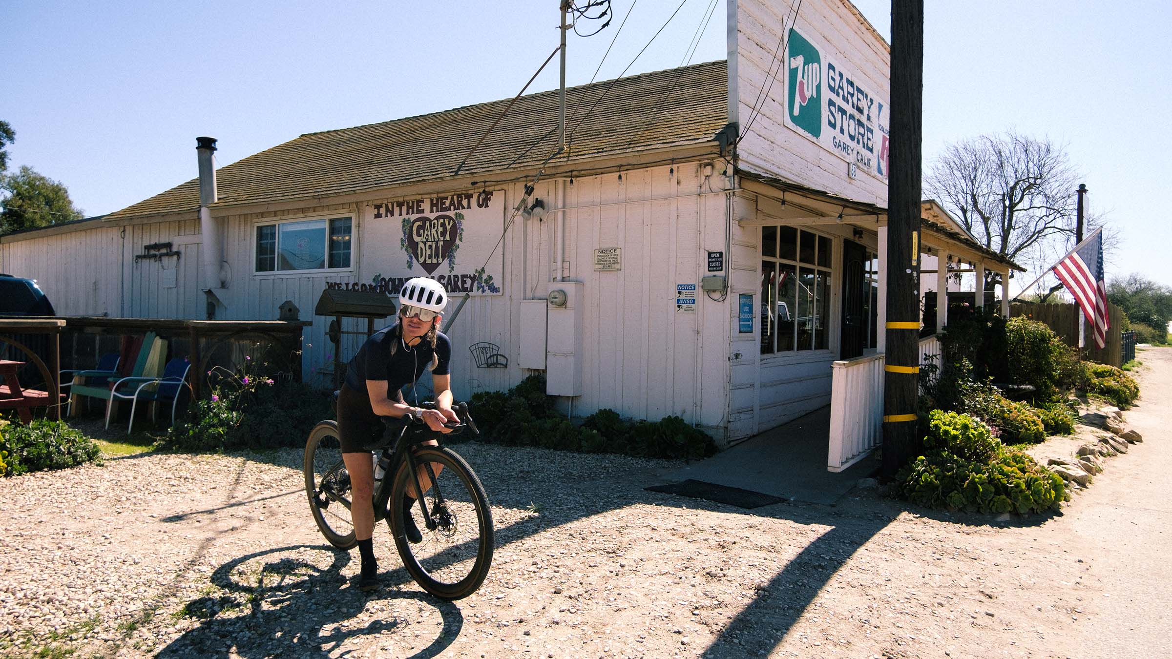
As soon as we exit Santa Ynez and Los Olivos, we have the roads all to ourselves. The landscape has changed from the jagged-steep mountains of yesterday, to now low-elevation rolling hills covered in grass, crops, or livestock. After a couple hours of riding we coasted into Garey Store. An unimagined stop on our trip, yet more than we could ever imagine. Like stepping into a time capsule from Hemingway era California. A handful of women are behind the counter of the little roadside market, bantering amongst each other and gossiping about the happenings of the tiny farm town of maybe 50 people. I grab a handful of snacks and Diana orders a peanut butter and jelly sandwich.
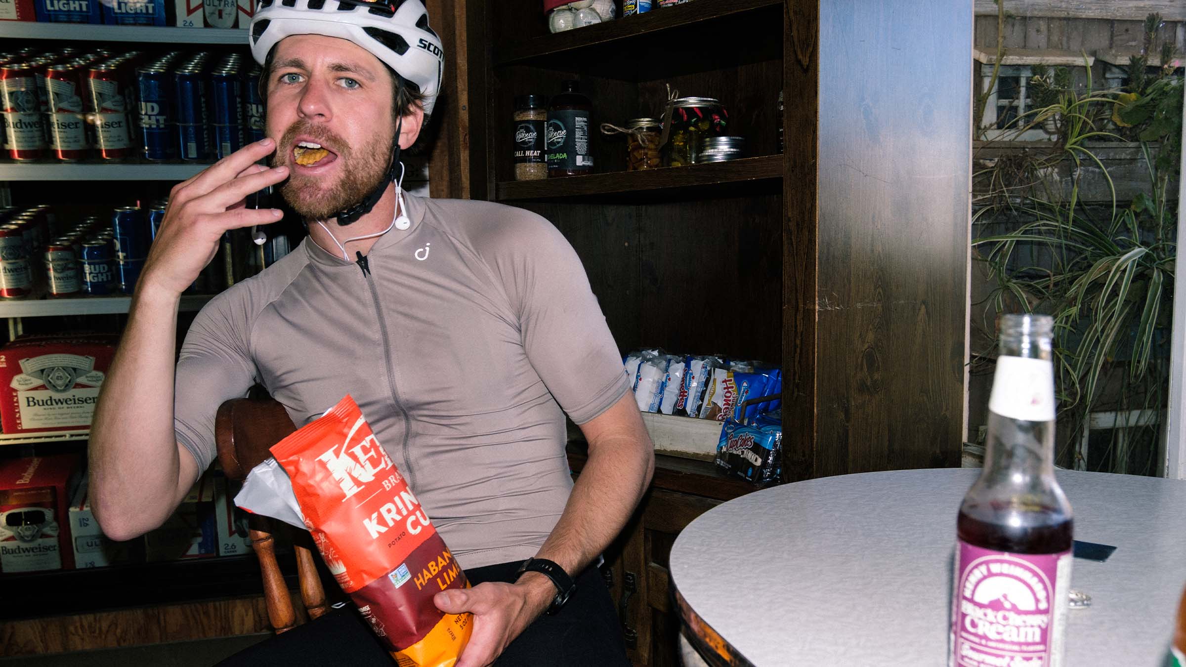
We sit at a small table near the door, observing the scene of locals rolling in for lunch, each one calling out to the women by name and the ladies behind the counter throwing snarky remarks back as if they’re exchanging blows with their family at Thanksgiving dinner. After filling our bottles with water and metaphorical cups with laughs, we set off.
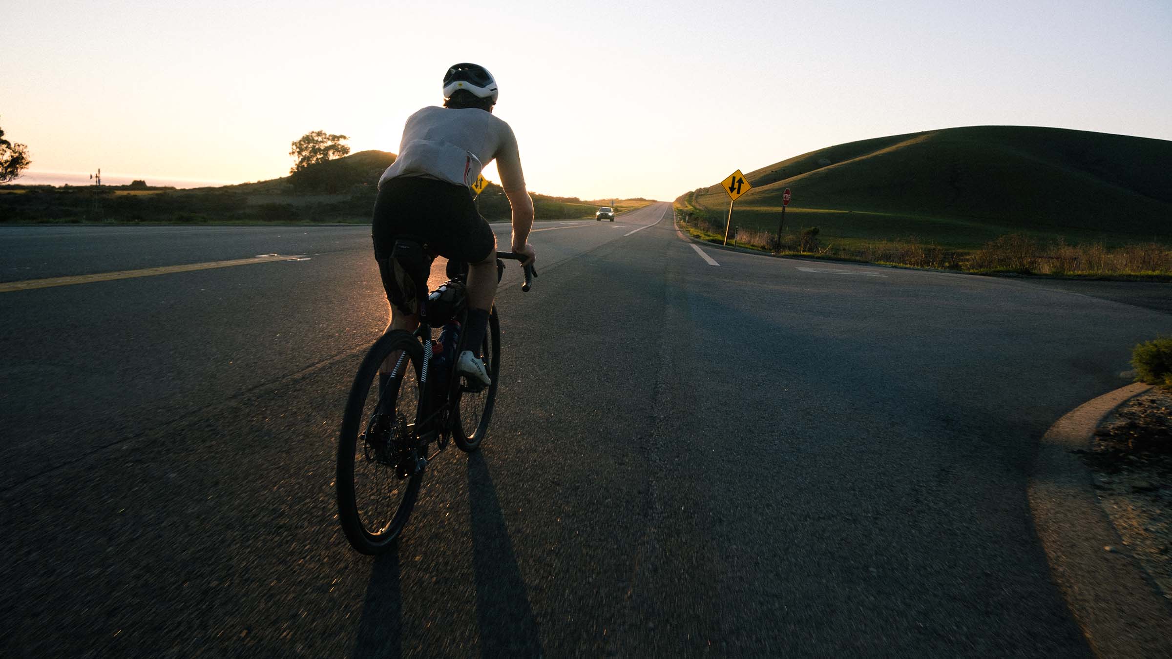
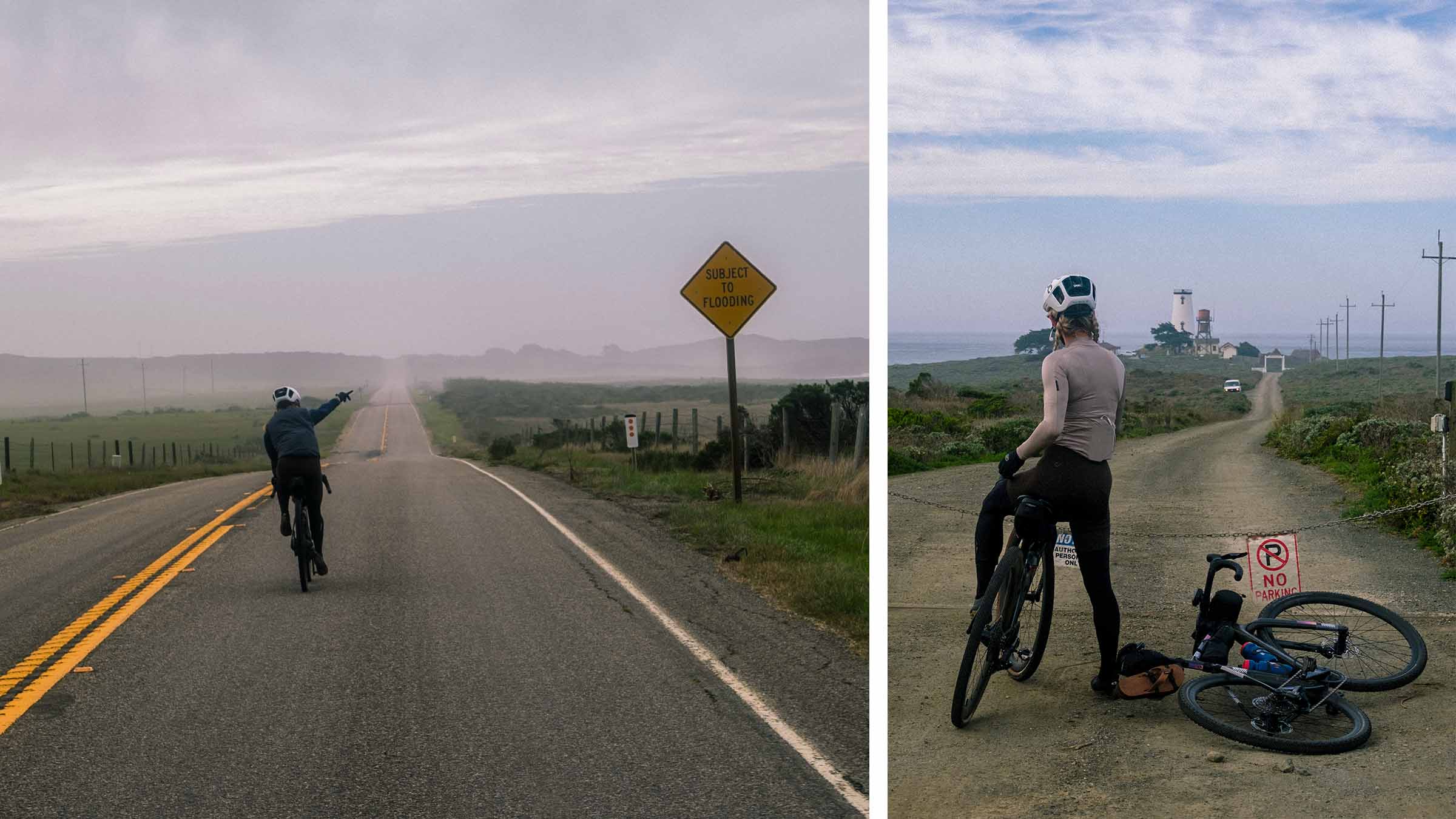
Back to the road we go. Only a few more hours till our next planned stop in San Luis Obispo (SLO). Both of us have music playing in one ear bud as we churn away at the pedals. The time goes quickly when you’re not thinking about much. My mind wanders as we cross into San Luis Obispo County. The air becomes a bit thicker. We must be close to the ocean. A slight change in scenery with more tree coated hills, we turn into a steeper valley, now moving north east. SLO must be close. The valley opens up a bit more, SLO is within our grasps. Our computers tell us to veer northwest, immediately getting hit by a wall of wind. This has to be the wind that everyone warned us of. The next ten miles are going to be rough.
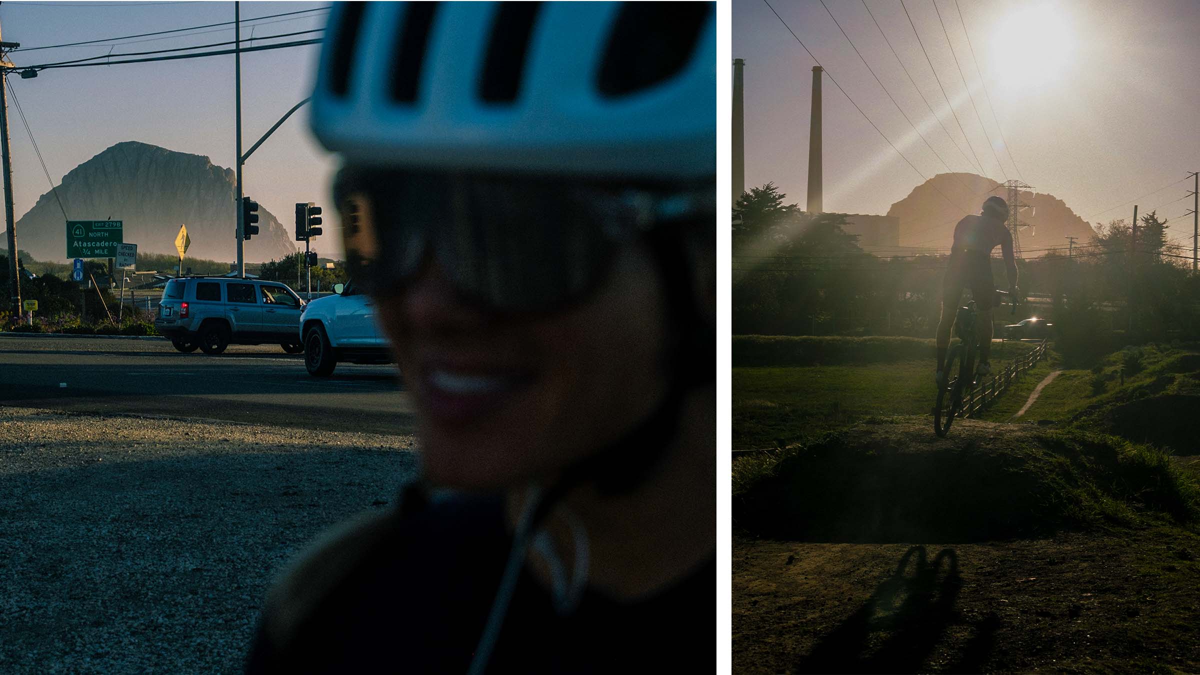
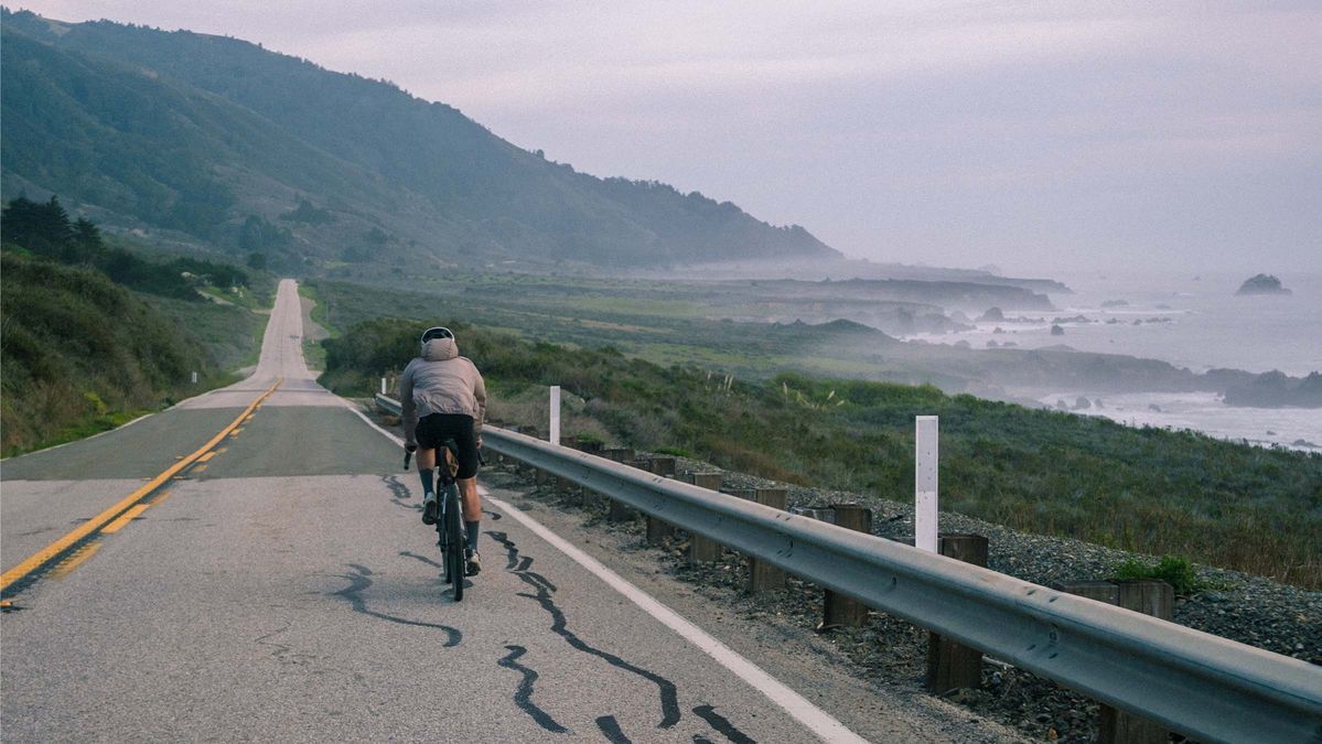
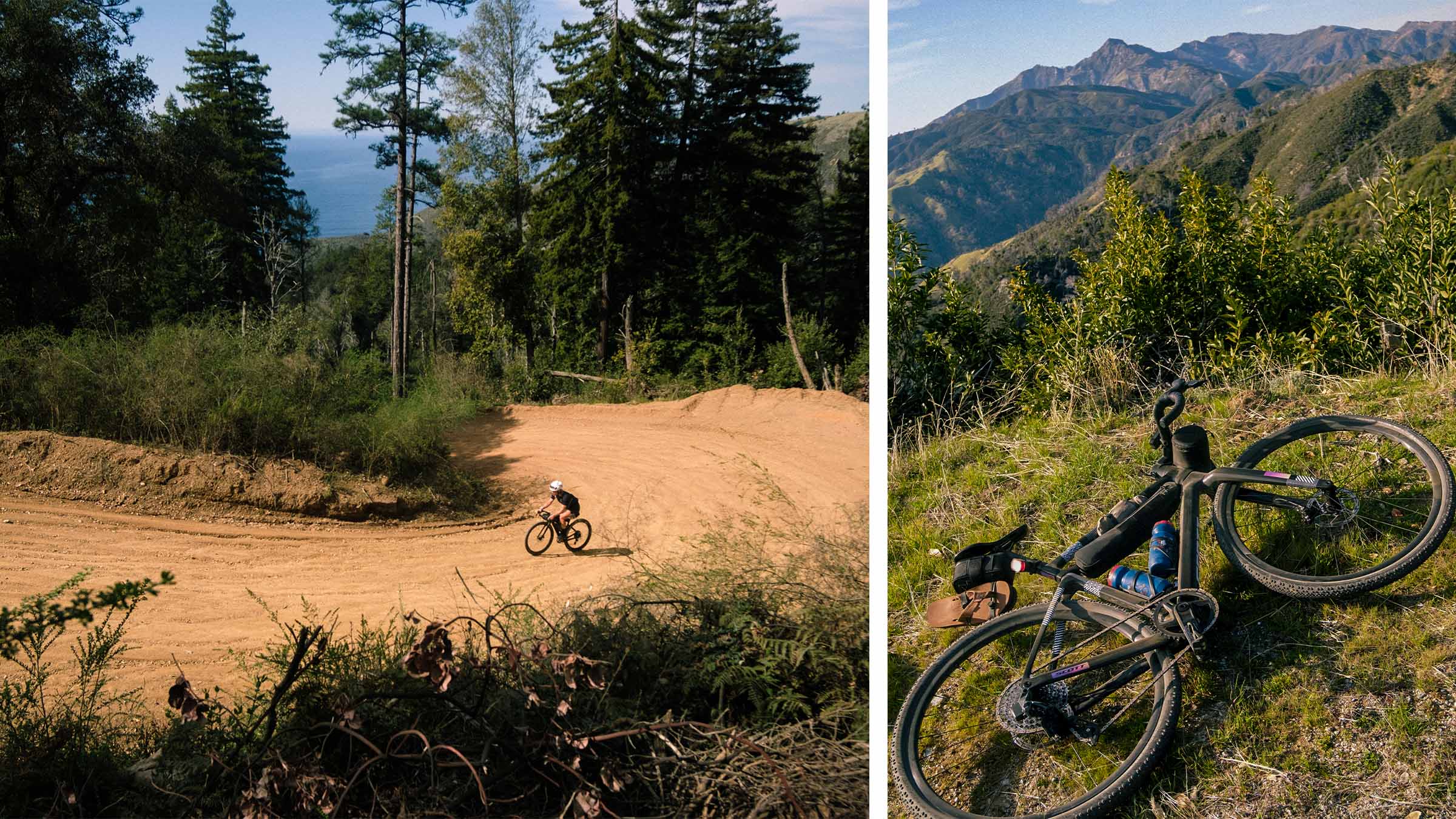
Departing northwest up and over the hills on our way to the coast, we battle the headwind once again. Eventually hopping off the highway to a frontage road, we look over to see the Morro Bay bike park right next to us! Diana insists that we stop in. We roll around and scope out the lines, then realize that you can probably hit the wooden kickers on a gravel bike… My internal dialogue is running rampant with thoughts and desire to hit the jumps. I know it’s not a good idea because we still have a lot of riding to go on this trip, but I also really want to ride them. I hand over the camera and decide I’m going to hit the first jump in the line. A bit nervous; I take a few cranks, line myself up with the take off, and begin my flight. Nothing spectacular, I land and roll away wishing I hit the rest of the jumps… We have more riding to get back to. The sun sets on us as we crank our way north along highway 1 on the coast. With hills on the horizon, we turn our lights on for the final miles to San Simeon.
DAY 3: Where The Road Ends
My sentiment towards waking up has now changed from yesterday. It’s a bit more difficult to crawl out of bed after riding 114 miles the day prior and knowing we have a large day of riding ahead. However, one thing stays certain, the miles aren’t going to ride themselves… We wipe the crust from our eyes and drag ourselves out of bed, straight on to our bikes, and out the door pointing north.
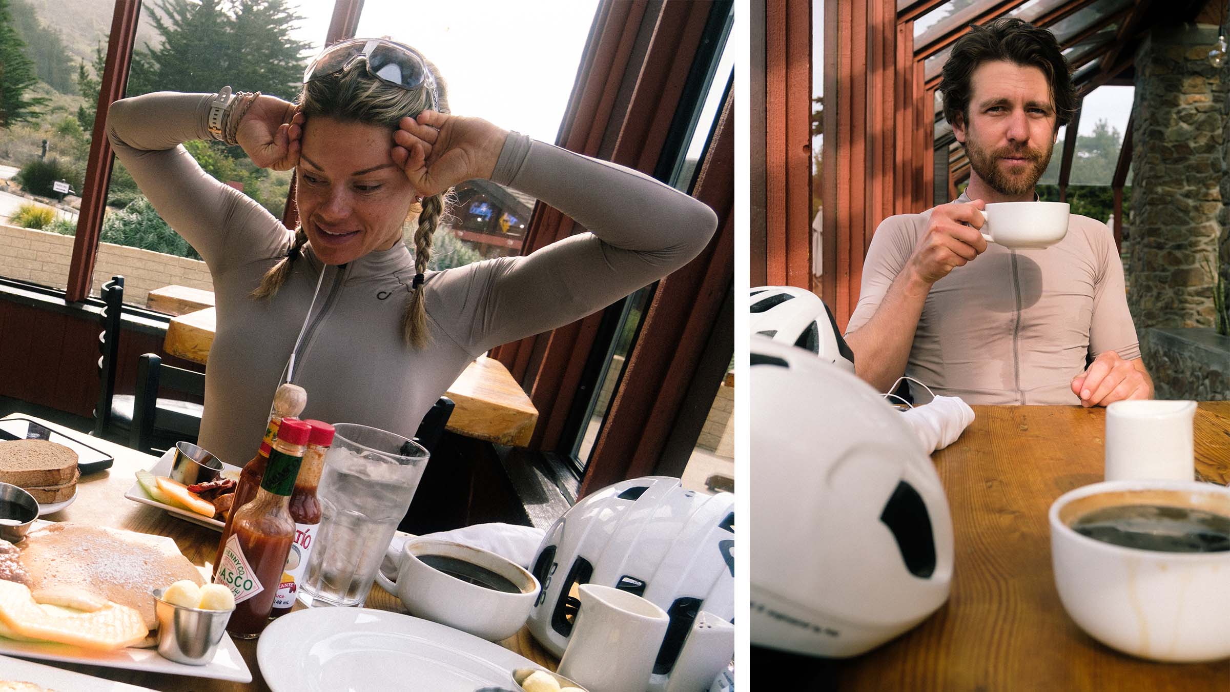
After about 20 miles I’m beginning to feel famished. Diana sarcastically says she’s feeling a bit peckish. Our next stop, Ragged Point, should be right around the corner; however, I’m not exactly sure what is going to be open there because it’s off-season in Big Sur. Sighing in relief, we coast into the resort with a hotel, restaurant, coffee shop, snack bar, and market. We head over to the restaurant. We order three meals for the two of us and hope it’s enough food.
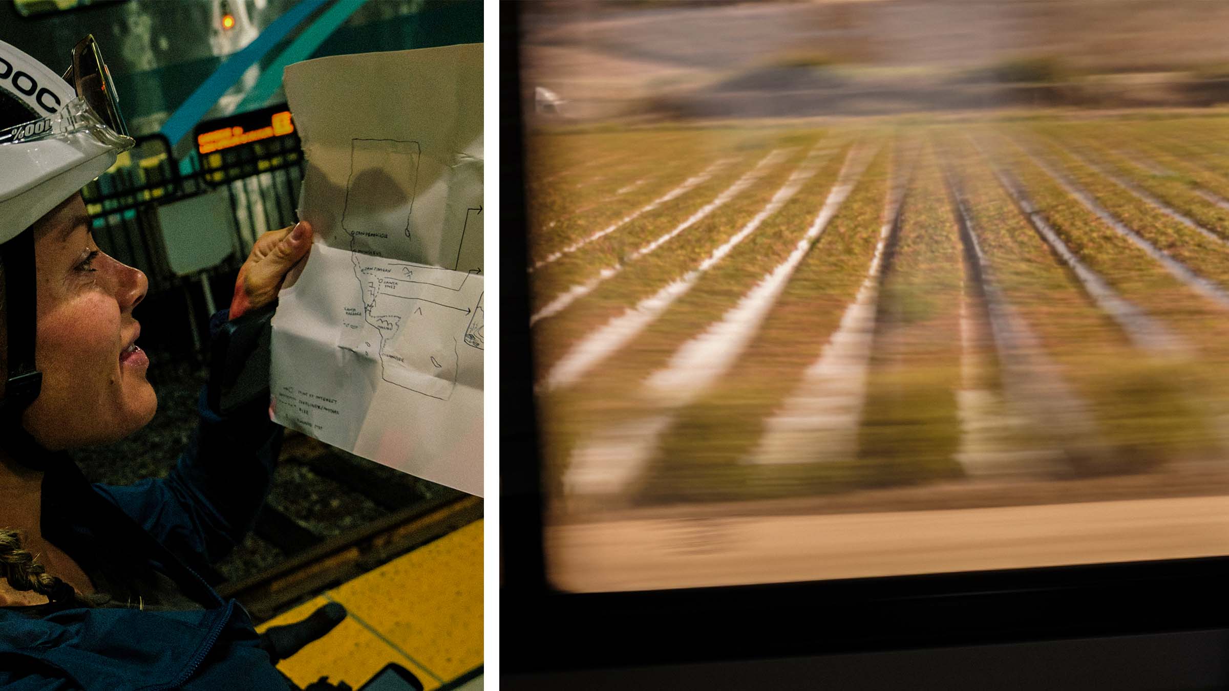
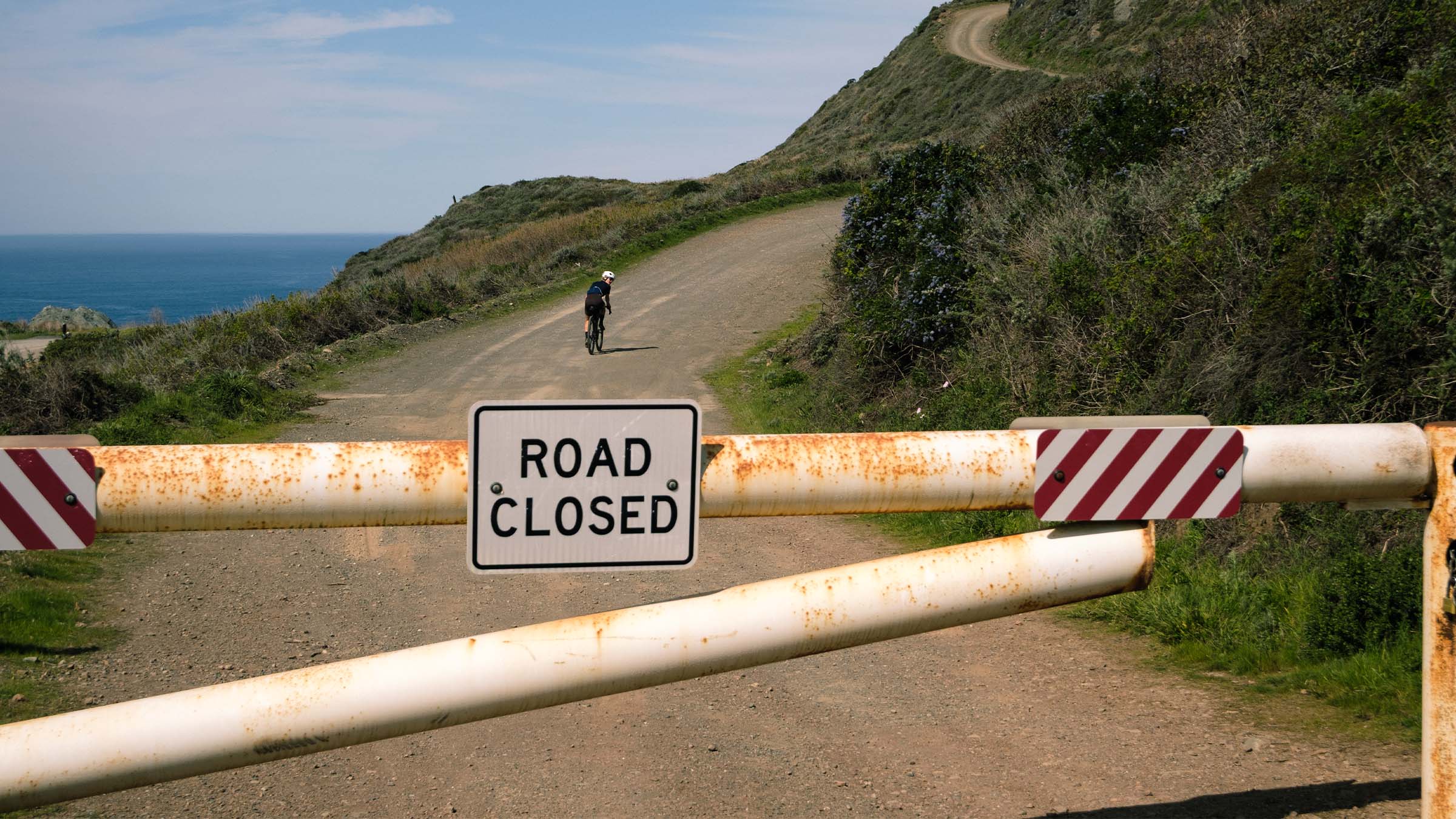
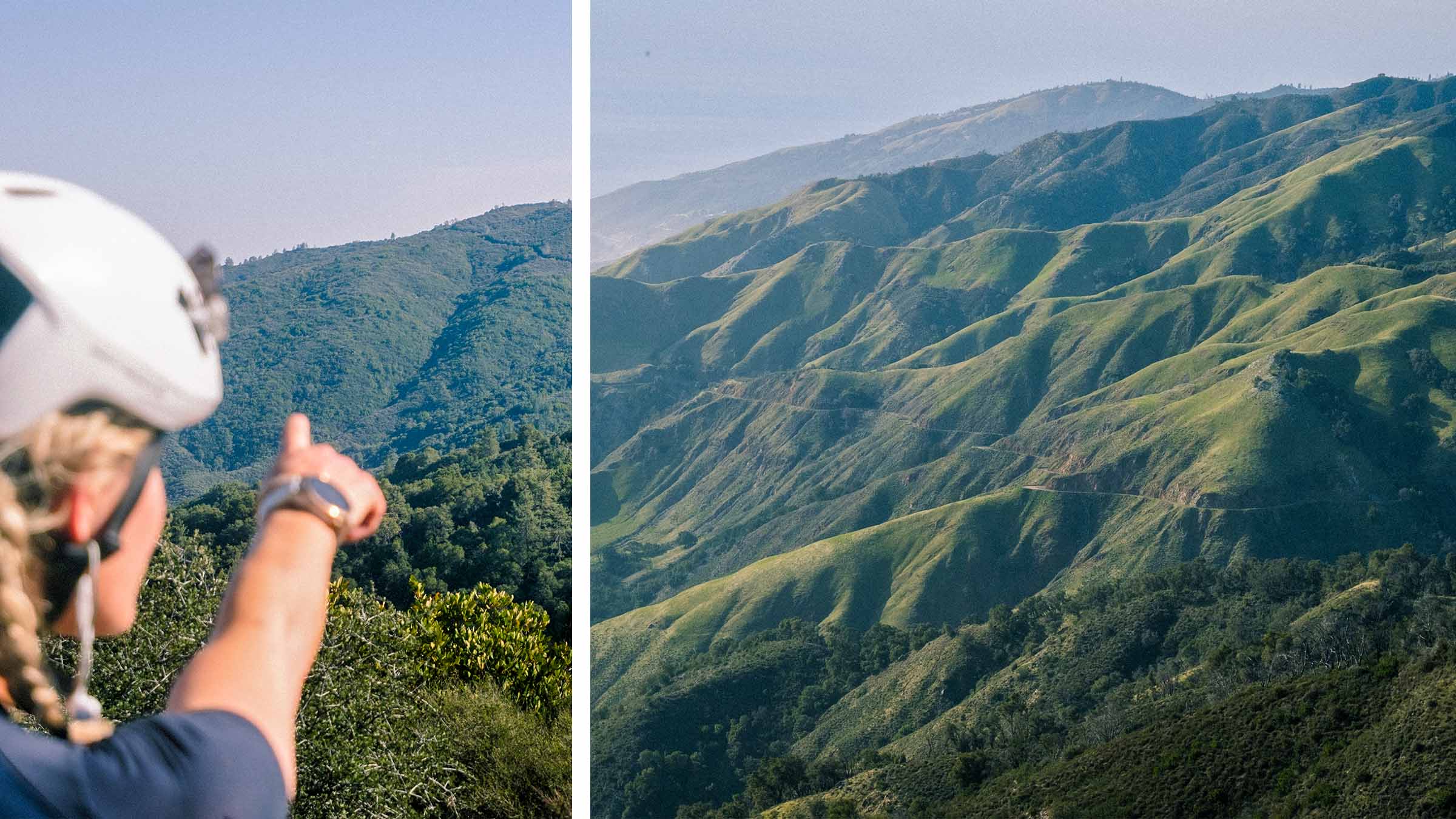
Now feeling full, I think it’s time to embark on our adventure for the day. I honestly don’t know if we’re going to be able to make it around the landslides. A few weeks ago I drew this route according to what I had read about the road closures and think we should be able to ride up into the mountains on dirt then across this long ridge and end up north of the construction where the landslides occurred; although, I’m only like 60% sure this will work.
Heading up the coast from Ragged Point, we get to Gorda and grab our last rations before turning into the mountains for a good few hours of climbing. Turning off on a dirt road and riding around the “road closed” gate, the terrain gets aggressively steep. Looking down at my computer it says this is climb 1 of 8 and is going to be 7.5 miles long with 3,500 feet of elevation gain. It’s also showing me that the climb is nearing a 20% grade… I spend the next 2 hours staring at my computer, suffering my way up this beast of a dirt road climb. The views are magnificent and the weather is a nearly unheard of 70 degrees in late February.
Now about halfway through our mountainous excursion, we get service for the first time in hours. I pull out my phone to look at a map to see where we are and how much further we need to go. Slowly my heart starts to sink; I don’t think we’re going to come out far enough north to avoid the road closures…
Looking over at Diana, I can tell she already knows I don’t have good news. “We have a couple options”, I tell her, “we can continue through the mountains and hope we eventually drop down west to the coast and end up above the road closures. Head back to Ragged Point for the night and figure out what we want to do from there tomorrow. Or we can go east once we hit Nacimiento Ferguson Road and ride towards the valley where highway 101 is and try to find a hotel there.” We’re in a bit of a bind. It’s 3 pm and the sun will be setting around 6 ish. We either need to ride around 40-50 more miles on dirt through the mountains to get to Big Sur Village, 35 miles to get back to Ragged Point, or at least another 50-60 miles on pavement to get close to a hotel out east. We’re also already 50 miles and 7,500 feet of climbing deep into the day…
A few moments go by and we collectively decide that it would probably be best to head back to Ragged Point. Honestly, I’m a bit relieved and happy to be heading back to Ragged Point. That breakfast we had earlier was straight out of a dream and I selfishly want to have it again tomorrow.
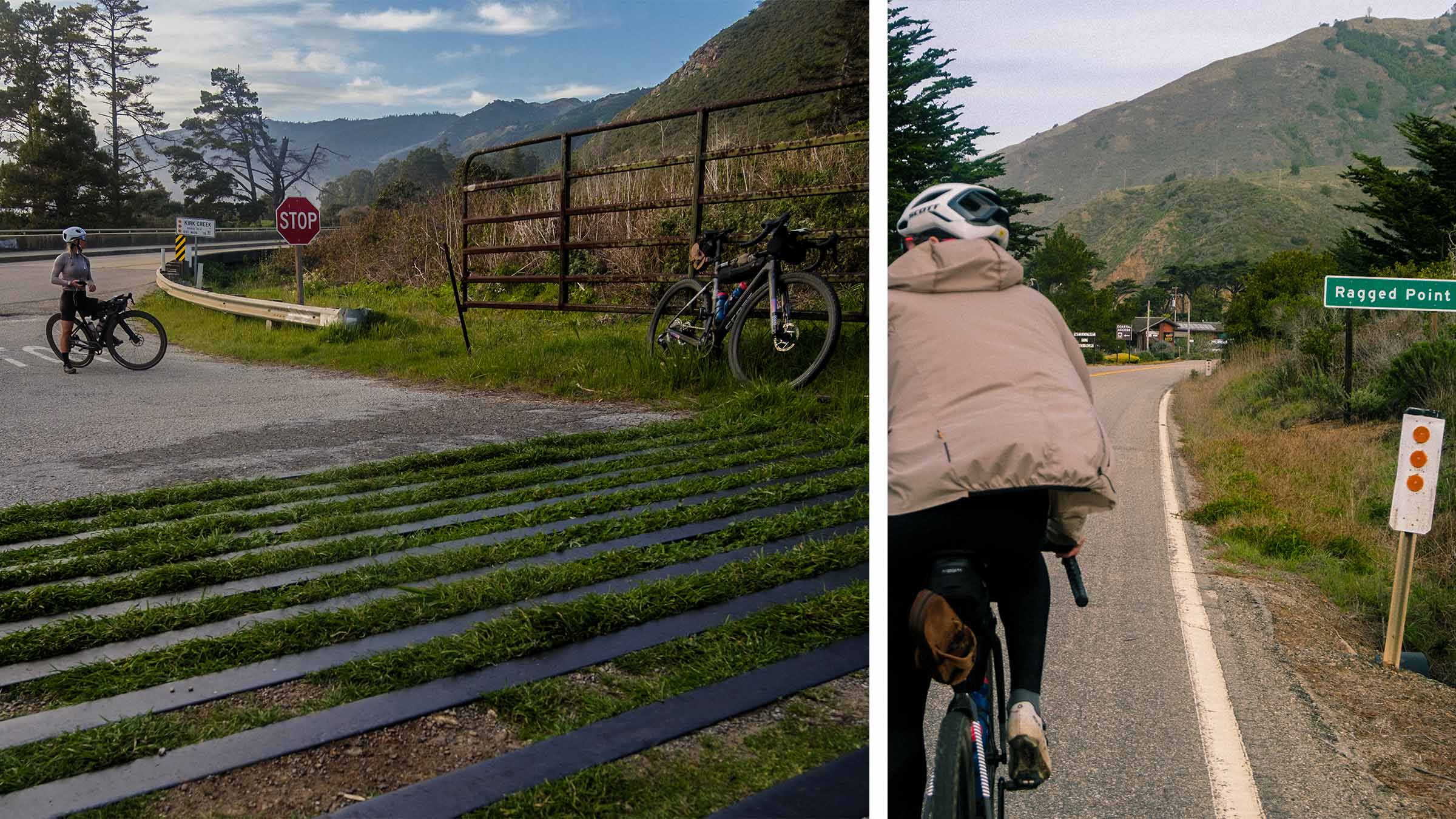
A palette of orange, blue, and purples paint the sky. We roll into Ragged Point and grab a room for the night before performing our evening chores of cleaning up, washing kits, and eating as much food as possible. We also have a decision to make, what are we going to do tomorrow? Originally we were to be in Monterey tonight and riding to San Francisco tomorrow, but that’s not happening.
DAY 4: All good adventures must come to an end
After over 10,000 feet of climbing and 85 miles yesterday, 114 miles the day before that, and 45 miles with 5,500 feet of climbing the day before that; our legs feel like bricks. The only thing getting us out of bed is the thought of another delicious breakfast at the restaurant here in Ragged Point. We drag ourselves that way, order a couple coffees along with the exact same breakfast we had yesterday. It’s exactly what I need at this moment.
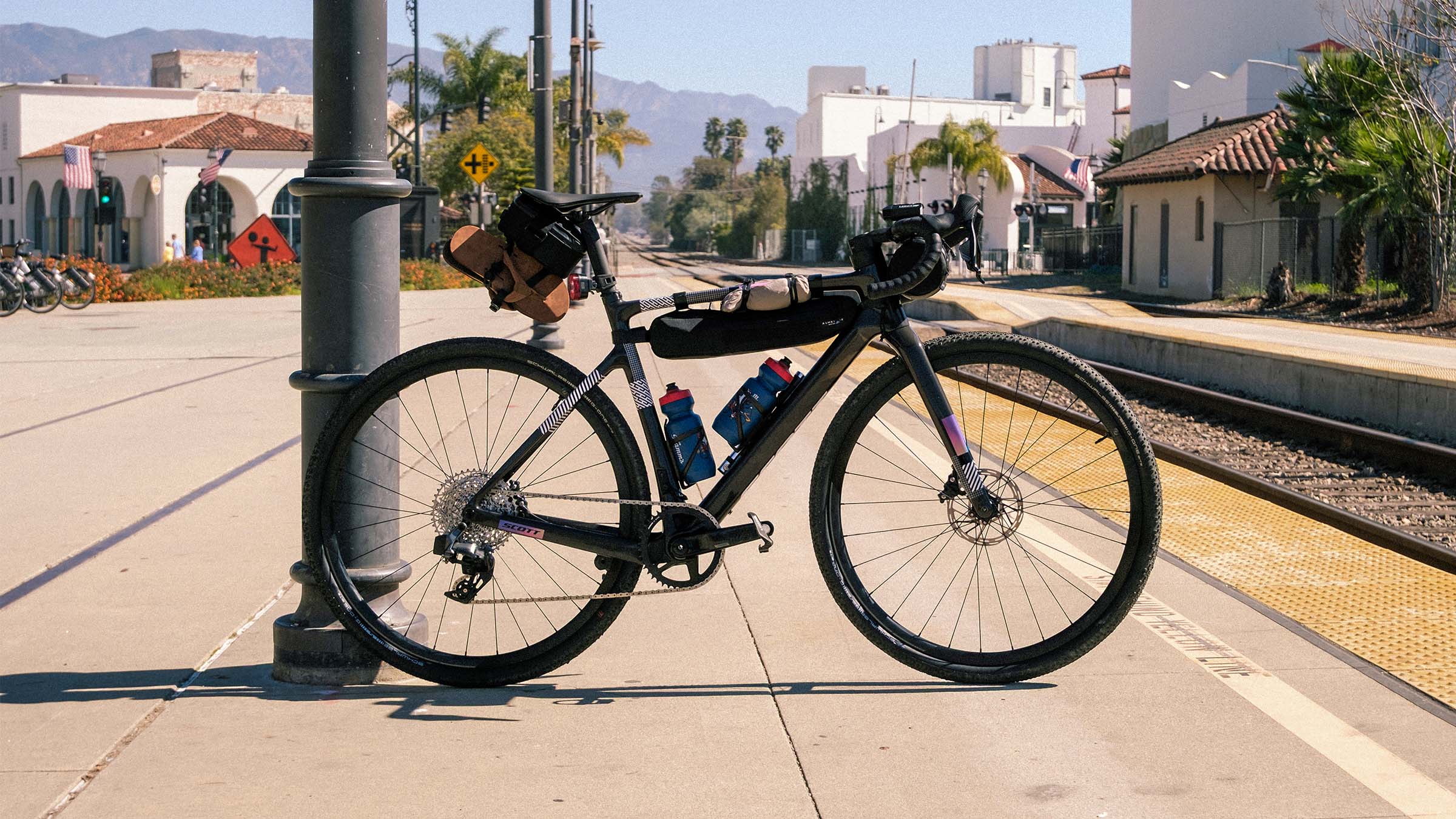
Back on the road for the final day, we decided to ride back to SLO to catch the train up north. With the wind at our backs, we pushed it back south to Cayucos, stopping briefly to fill our bottles before heading east to SLO. As we get closer to SLO, my stomach begins to growl, and my legs are zapped of energy. My mind is fully focused on getting to the taqueria and devouring a shrimp burrito.
We finally made it to SLO and burritos have been acquired! Post burritos, we stroll over to Firestone Grill to pick up tri tip sandwiches for the 6 hour train ride home. With sandwiches in hand we head for the train station and with only 7 minutes to spare, we arrive at the train station to find out we may be too late to check our bikes on the train. Luckily everyone was incredibly friendly and got our bikes on just in time for departure. We fall into our seats, recline back, kick up our feet, and begin to laugh hysterically at the ridiculousness of what we have just done.