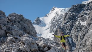
Redemption Accomplished
Due to unusual warm temperature, the date of the attempt had to be advanced a few weeks. Marco, husband and father wants to limit the risks of an already challenging and exposed route.
That route has been covered for the first time back on August 1st 1890 by Luigi Graselli , John Bonin and Achille Ratti , the future Pope Pius XI , along with guides Joseph Gadin and Alexis Proment.
Total distance: 49,6 km
Elevation Gain: 3.750 m
FKT before Marco’s attempt: Fabio Meraldi (1995) 6h45’24”. 4h28.36 (up) and 2h16.48 (down)
When did you decided to one day go for the record up and down Mont Blanc from Courmayeur?
It was long time ago, when I was only 16, Adriano Greco, my first coach and skyrunning pioneer, took me at the Mount Blanc Skymarathon to watch the race. I was so passionate of running and high mountains as well, so this race was a true eye opener and would feed my inspiration for years to come. I dreamed several times these crevasses and the white ridges so close to the sky, and those "crazy" super athletes who were running down incredible slopes! I said to myself, one day my wish is to go back there and climb it as quick as I can.
How did the attempt go?
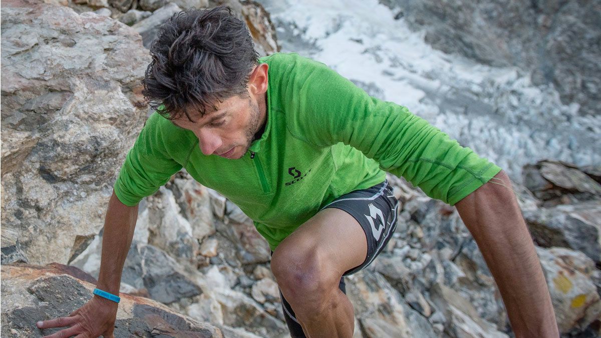
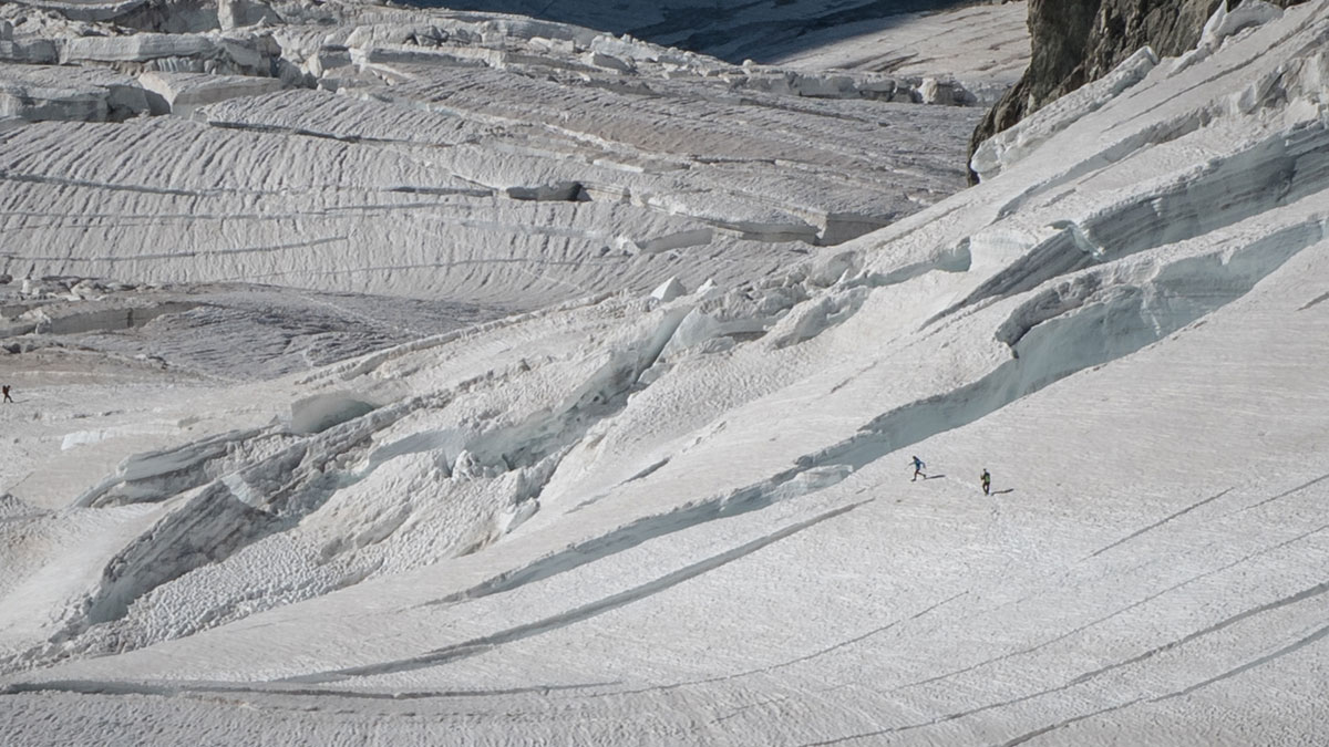
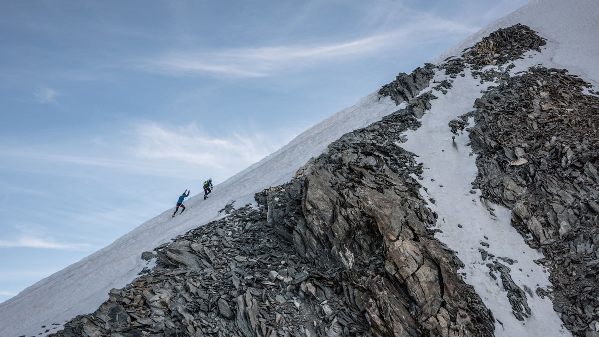
The mountain conditions weren't so good in the last weeks due to the hot days that have melted all the snow on the glacier. I therefore had to remain extremely focused on these sections for both the way up and down. I enjoyed them very much but I think I've lost lots of strength there. On the last 11km of pavement road, the tiredness finally hit me, hard. I had some struggling moments, trying to manage major cramping in my adductors the best I could.
The record was obviously always at the back of my mind and such struggle in the end forced me to give it all until the end, fearing I’d lose the time I had made up on the ascent.
Do you feel at peace now you have been able to successfully get your redemption from the race you were denied so many years back?
Honestly I can say it was a very challenging experience. I gave my best in planning the attempt in all its small details, as well as training with motivations to achieve the aim. I am sure this is more difficult than take part into a race where everything is already done from the organization. So, probably I feel like I'm more satisfied because I built my dream from the bottom to the summit. I received tremendous help from a few people who fully supported my project. Photographer Fabio Menino, for example, went out of his way to assist me, and it was so helpful for many reasons!
What’s next for you now?
There are a few dreams left to continue my project. But I prefer to keep the secret because dreams are personal sometimes and it's good to share with others when you are near to understand if they can be true or not! ;)
Description of the full route, with distance and elevations is described below.
Courmayeur (1.224 m) 0,0 km
Bivio Val Veny (1.236 m) 1,5 km
Santuario Notre Dame de la Guerison ( 1.440 m) 3,8 km
Bivio Purtdud (1.537 m) 5,2 km
Baita Pramotton (1.581 m) 8 km
La Visaille (1.679 m) 8,8 km
Combal (1.987 m) 11,5 km
End of the road section and start of the trail.
Rifugio Gonnella ( 3.071 m) 18 km
Col des Aiguilles Grises (3.811 m) 21 km
Piton des Italiens (4.002 m) 21,4 km
Dôme du Goûter (4.306 m) 22,2 km
Capanna Vallot (4.362 m) 23 km
Cresta de Bosses (4.500 m) 23,5 km
Montre Bianco (4.810) 24,8 km
Cresta de Bosses (4.500 m) 25,3 km
Capanna Vallot (4.362 m) 26,6 km
Dôme du Goûter (4.306 m) 27,4 km
Piton des Italiens (4.002 m) 28,2 km
Col des Aiguilles Grises (3.811 m) 28,4 km
Rifugio Gonnella ( 3.071 m) 31,6 km
Combal (1.987 m) 38,1 km
Back to the road section
La Visaille (1.679 m) 40,8 km
Baita Pramotton (1.581 m) 41,6 km
Bivio Purtdud (1.537 m) 44,4 km
Santuario Notre Dame de la Guerison ( 1.440 m) 45,8 km
Bivio Val Veny (1.236 m) 48,1 km
Courmayeur (1.224 m) 49,6 km